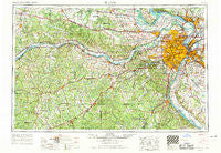
~ St Louis MO topo map, 1:250000 scale, 1 X 2 Degree, Historical, 1963, updated 1970
St Louis, Missouri, USGS topographic map dated 1963.
Includes geographic coordinates (latitude and longitude). This topographic map is suitable for hiking, camping, and exploring, or framing it as a wall map.
Printed on-demand using high resolution imagery, on heavy weight and acid free paper, or alternatively on a variety of synthetic materials.
Topos available on paper, Waterproof, Poly, or Tyvek. Usually shipping rolled, unless combined with other folded maps in one order.
- Product Number: USGS-5575946
- Free digital map download (high-resolution, GeoPDF): St Louis, Missouri (file size: 24 MB)
- Map Size: please refer to the dimensions of the GeoPDF map above
- Weight (paper map): ca. 55 grams
- Map Type: POD USGS Topographic Map
- Map Series: HTMC
- Map Verison: Historical
- Cell ID: 69004
- Scan ID: 325630
- Imprint Year: 1970
- Woodland Tint: Yes
- Aerial Photo Year: 1961
- Edit Year: 1969
- Field Check Year: 1963
- Datum: Unstated
- Map Projection: Transverse Mercator
- Map published by United States Geological Survey
- Map published by: Military, Other
- Map Language: English
- Scanner Resolution: 600 dpi
- Map Cell Name: Saint Louis
- Grid size: 1 X 2 Degree
- Date on map: 1963
- Map Scale: 1:250000
- Geographical region: Missouri, United States
Neighboring Maps:
All neighboring USGS topo maps are available for sale online at a variety of scales.
Spatial coverage:
Topo map St Louis, Missouri, covers the geographical area associated the following places:
- Dartmound (historical) - Tillman - Castle Point - Macedonia Neighborhood - Prater - White House - Melville - Hensley - Point (historical) - Glencoe - Mud Town - Beechville - Southhampton - Harrison Mills - Rosemont - Bridgeton - Peruque - Madison Station - Saint George - Boschertown - Jefferson Heights - Bloomsdale - Stanton - New Hanover - Granite City - Morrison - Grubville - Fenton - Jarvis - Oldenburg - Woods - Wydown Skinker - Labadie - Lake Siding - South Roxana - Royal - Stallings - Jake Prairie - Oetters - North Dupo - Knorpp - Schundler - Country Club Hills - O'Fallon - Defiance - Krakow - Lonedell - Creve Coeur - Herculaneum - Maryland Heights - Troy - Lake Ford (historical) - Cedar Hill - Aptus - Saint Thomas - Wells-Goodfellow - Moro - Pitcher - Union - Vans Camp - Echo Lake Ranch - Egbert - Mary Ridge - Weldon Spring Heights - Wood River - Hyde Park - Sulphur Springs - Tebbetts - College Hill - Shoveltown - Mapaville - Summit - Fosterburg - Hillsdale - Bella Villa - Deer Plain - West Sullivan - Woodville (historical) - Eureka - Gasconade - Roachtown - Big Spring - Witte Ford (historical) - Saint Joe - Cannon Mines - Peabody Darst Webbe - Fourmile Corner - Clover Bottom - Bliss - Robidoux - Camp Wyman - Oak Grove Village - Roxana - Jedburgh - Richwoods - New Haven - Boles - North Alton - Cave Hill - Matson
- Map Area ID: AREA3938-92-90
- Northwest corner Lat/Long code: USGSNW39-92
- Northeast corner Lat/Long code: USGSNE39-90
- Southwest corner Lat/Long code: USGSSW38-92
- Southeast corner Lat/Long code: USGSSE38-90
- Northern map edge Latitude: 39
- Southern map edge Latitude: 38
- Western map edge Longitude: -92
- Eastern map edge Longitude: -90

