
~ St Louis MO topo map, 1:250000 scale, 1 X 2 Degree, Historical, 1966, updated 1966
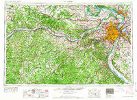
St Louis, Missouri, USGS topographic map dated 1966.
Includes geographic coordinates (latitude and longitude). This topographic map is suitable for hiking, camping, and exploring, or framing it as a wall map.
Printed on-demand using high resolution imagery, on heavy weight and acid free paper, or alternatively on a variety of synthetic materials.
Topos available on paper, Waterproof, Poly, or Tyvek. Usually shipping rolled, unless combined with other folded maps in one order.
- Product Number: USGS-5575942
- Free digital map download (high-resolution, GeoPDF): St Louis, Missouri (file size: 25 MB)
- Map Size: please refer to the dimensions of the GeoPDF map above
- Weight (paper map): ca. 55 grams
- Map Type: POD USGS Topographic Map
- Map Series: HTMC
- Map Verison: Historical
- Cell ID: 69004
- Scan ID: 325628
- Imprint Year: 1966
- Woodland Tint: Yes
- Field Check Year: 1963
- Datum: Unstated
- Map Projection: Transverse Mercator
- Map published by United States Army Corps of Engineers
- Map published by United States Army
- Map Language: English
- Scanner Resolution: 600 dpi
- Map Cell Name: Saint Louis
- Grid size: 1 X 2 Degree
- Date on map: 1966
- Map Scale: 1:250000
- Geographical region: Missouri, United States
Neighboring Maps:
All neighboring USGS topo maps are available for sale online at a variety of scales.
Spatial coverage:
Topo map St Louis, Missouri, covers the geographical area associated the following places:
- Twin Springs - New Woollam - Earth City - Hillsboro - South Shore - Ellisville - Wiffenberg - Timber Trace - West Sullivan - Etlah - Covenant Blu-Grand Center - House Springs - Mitchie - Isbell (historical) - Centaur - Freeburg - Camp Wyman - Prairie du Rocher - Stevens - Shaw - Twin Oaks - Crook - Readsville - Aspenhoff - Parkdale - Shibboleth - Bailey - Silica - Fountain Park - Madonnaville - Peerless Park - Union Hill - South Roxana - Fox Creek - Beaufort - Callaway - Paydown - Des Peres - Campbellton - Saint Clair - Delhi - Orchard Farm - Belews Creek - Gratiot - Hope - Truesdale - Whitecorn - Koester - Murphy - Little Berger - Bonfils - Sunnyside - Bel-Nor - Bend - Edgemont - Eureka - Hinch - Rockford Beach - Cedar Hill - Prater - Daggetts Ford (historical) - Waterloo - Golden Gardens - Matson - Saint Charles - Byron - Eagle Park - Ames - Crest Hill - Kruegerville (historical) - Gilmore - Fults - Wilbur Park - Huntleigh - Normandy - Machens - Piney Park - Three Creeks Village - Wilkie - Stallings - Femme Osage - Festus - East Alton - De Soto - Richmond Heights - Union - Hartford - Stolpe - Marthasville - Olympian Village - Drewel Ford (historical) - North Pointe - Koenig - Fox Park - Falling Spring - Merrimac - Oakwood Heights - Suelthaus Ford - Portage Des Sioux - Plattin
- Map Area ID: AREA3938-92-90
- Northwest corner Lat/Long code: USGSNW39-92
- Northeast corner Lat/Long code: USGSNE39-90
- Southwest corner Lat/Long code: USGSSW38-92
- Southeast corner Lat/Long code: USGSSE38-90
- Northern map edge Latitude: 39
- Southern map edge Latitude: 38
- Western map edge Longitude: -92
- Eastern map edge Longitude: -90


