
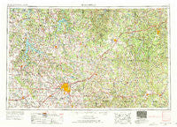
~ Springfield MO topo map, 1:250000 scale, 1 X 2 Degree, Historical, 1954, updated 1972
Springfield, Missouri, USGS topographic map dated 1954.
Includes geographic coordinates (latitude and longitude). This topographic map is suitable for hiking, camping, and exploring, or framing it as a wall map.
Printed on-demand using high resolution imagery, on heavy weight and acid free paper, or alternatively on a variety of synthetic materials.
Topos available on paper, Waterproof, Poly, or Tyvek. Usually shipping rolled, unless combined with other folded maps in one order.
- Product Number: USGS-5575932
- Free digital map download (high-resolution, GeoPDF): Springfield, Missouri (file size: 23 MB)
- Map Size: please refer to the dimensions of the GeoPDF map above
- Weight (paper map): ca. 55 grams
- Map Type: POD USGS Topographic Map
- Map Series: HTMC
- Map Verison: Historical
- Cell ID: 69036
- Scan ID: 325623
- Imprint Year: 1972
- Woodland Tint: Yes
- Edit Year: 1969
- Field Check Year: 1954
- Datum: Unstated
- Map Projection: Transverse Mercator
- Map published by United States Geological Survey
- Map published by: Military, Other
- Map Language: English
- Scanner Resolution: 600 dpi
- Map Cell Name: Springfield
- Grid size: 1 X 2 Degree
- Date on map: 1954
- Map Scale: 1:250000
- Geographical region: Missouri, United States
Neighboring Maps:
All neighboring USGS topo maps are available for sale online at a variety of scales.
Spatial coverage:
Topo map Springfield, Missouri, covers the geographical area associated the following places:
- Hugo - Mohawk Corner - Dunn - Schofield - West Lebanon - Oyer - Smith Ford (historical) - Carns Ford - Avalon Park - Sleeper - Walnut Grove - Branch - Charity - Dermott - Comet - Hoberg - Odin - Dallion Ford (historical) - Griffin - Hooker - Yeakley - Crossroads Store - Arcola - Springfield - Abo - Opal - Abadyl - Goodnight - Wall Street - Antler (historical) - Munger Resort (historical) - Stinson - Delmar - Mount Zion - Three Island Resort - Ellsworth - Pembina - Leadmine - Aldrich - Pembina - Plano - Heady - Phenix - Olathia - Olinger - Winnipeg - Lockwood - Billings - Mitchells Corner - Cedar Springs - Berry Ford (historical) - Cane Hill - Forkners Hill - Violet - Corkery - Midway - Owens - Rex - Claud - Bendavis - Eudora - Hahatonka - Prior - Rimby - Roseville - Zenar - Kings Point - Conway - Cave Spring - Spencer - Call - Hiatt (historical) - Bidwell - Duke - Hardyville - Thorpe - Dilday Mill - Riverpark - Helm - Wheatland - Bennett Springs - Pennsboro - Drynob - Fuson - Bois D'Arc - Logan - Albatross - Cedar Vista - Marshfield - Granada - Raney - Lon - Nixa - Wood Hill - Brush Creek - Fair Grove - Republic - Fowler - Hartville - Roby
- Map Area ID: AREA3837-94-92
- Northwest corner Lat/Long code: USGSNW38-94
- Northeast corner Lat/Long code: USGSNE38-92
- Southwest corner Lat/Long code: USGSSW37-94
- Southeast corner Lat/Long code: USGSSE37-92
- Northern map edge Latitude: 38
- Southern map edge Latitude: 37
- Western map edge Longitude: -94
- Eastern map edge Longitude: -92


