
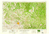
~ Springfield MO topo map, 1:250000 scale, 1 X 2 Degree, Historical, 1959, updated 1959
Springfield, Missouri, USGS topographic map dated 1959.
Includes geographic coordinates (latitude and longitude). This topographic map is suitable for hiking, camping, and exploring, or framing it as a wall map.
Printed on-demand using high resolution imagery, on heavy weight and acid free paper, or alternatively on a variety of synthetic materials.
Topos available on paper, Waterproof, Poly, or Tyvek. Usually shipping rolled, unless combined with other folded maps in one order.
- Product Number: USGS-5575926
- Free digital map download (high-resolution, GeoPDF): Springfield, Missouri (file size: 24 MB)
- Map Size: please refer to the dimensions of the GeoPDF map above
- Weight (paper map): ca. 55 grams
- Map Type: POD USGS Topographic Map
- Map Series: HTMC
- Map Verison: Historical
- Cell ID: 69036
- Scan ID: 325620
- Imprint Year: 1959
- Woodland Tint: Yes
- Field Check Year: 1954
- Datum: Unstated
- Map Projection: Transverse Mercator
- Map published by United States Army Corps of Engineers
- Map published by United States Army
- Map Language: English
- Scanner Resolution: 600 dpi
- Map Cell Name: Springfield
- Grid size: 1 X 2 Degree
- Date on map: 1959
- Map Scale: 1:250000
- Geographical region: Missouri, United States
Neighboring Maps:
All neighboring USGS topo maps are available for sale online at a variety of scales.
Spatial coverage:
Topo map Springfield, Missouri, covers the geographical area associated the following places:
- Eldridge - Fair Grove - Pape - Galmey - Dunnegan - Valley Water Mills - Alsup - Grace - Winnipeg - Mazzaville Resort - Mathis - Cross Way - Thorpe - Competition - Graydon Springs - Hazelgreen - Fair Play - Hackler Ford (historical) - Lindstrew Ford - Coal Hill - Sparta - Westfield - Edanville - Turley - Garnsey - Kieseweltter Resort - Dewey (historical) - Gresham (historical) - Langston - Dixon - Saint George - West Lebanon - Granada - Mohawk Corner - Susanna - Stotts City - Plato - Burns - Yeakley - Pittsburg - Pacetown - Ozark - Crabbs (historical) - Abo - Rayborn - Cedar Gap - Seymour - Hancock - Comet - Preston - Tiffin - Rock Prairie - Drew - Boaz - Willard - Lon - Boyer - Pearl - Willowville - Emmett (historical) - Foose - Filer - Almon - Ladd - Call - Pembina - Everton - Success - Battlefield - Raney - Ash Grove - West Bend - Round Grove - Three Island Resort - Ivy - All - Smith Ford (historical) - Gerster - Sunset - Earnestville - Pembina - Compton (historical) - Meinert - Hillhouse Addition - Tracy - Bois D'Arc - Story (historical) - Limekiln Ford (historical) - Depew - Agnes - Landrum - Hardyville - Hackney - McKinley - Redtop - Helm - Dunn - Bracken - Wheelers Mill - Tingley
- Map Area ID: AREA3837-94-92
- Northwest corner Lat/Long code: USGSNW38-94
- Northeast corner Lat/Long code: USGSNE38-92
- Southwest corner Lat/Long code: USGSSW37-94
- Southeast corner Lat/Long code: USGSSE37-92
- Northern map edge Latitude: 38
- Southern map edge Latitude: 37
- Western map edge Longitude: -94
- Eastern map edge Longitude: -92


