
~ Rolla MO topo map, 1:250000 scale, 1 X 2 Degree, Historical, 1953, updated 1953
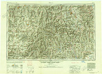
Rolla, Missouri, USGS topographic map dated 1953.
Includes geographic coordinates (latitude and longitude). This topographic map is suitable for hiking, camping, and exploring, or framing it as a wall map.
Printed on-demand using high resolution imagery, on heavy weight and acid free paper, or alternatively on a variety of synthetic materials.
Topos available on paper, Waterproof, Poly, or Tyvek. Usually shipping rolled, unless combined with other folded maps in one order.
- Product Number: USGS-5575914
- Free digital map download (high-resolution, GeoPDF): Rolla, Missouri (file size: 27 MB)
- Map Size: please refer to the dimensions of the GeoPDF map above
- Weight (paper map): ca. 55 grams
- Map Type: POD USGS Topographic Map
- Map Series: HTMC
- Map Verison: Historical
- Cell ID: 72245
- Scan ID: 325614
- Imprint Year: 1953
- Aerial Photo Year: 1945
- Datum: NAD27
- Map Projection: Transverse Mercator
- Map published by United States Army Corps of Engineers
- Map published by United States Army
- Map Language: English
- Scanner Resolution: 600 dpi
- Map Cell Name: Rolla
- Grid size: 1 X 2 Degree
- Date on map: 1953
- Map Scale: 1:250000
- Geographical region: Missouri, United States
Neighboring Maps:
All neighboring USGS topo maps are available for sale online at a variety of scales.
Spatial coverage:
Topo map Rolla, Missouri, covers the geographical area associated the following places:
- French Town - McGee - Cook Station - Brunot - Newburg - Mine La Motte - Meramec Springs (historical) - Hahn - Goltra - Catherine Place - Buick - Fountain Farm - Reynolds - Midvale - Bessville - Dillon - Precinct - Hurryville - Cobalt Village - Old Greenville (historical) - Minimum - Arlington - Fredericktown - Palmer - Kinderpost - Berryman - Daytown - Delaware - Pilot Knob - Davisville - Beulah - Higdon - Wildwoods - Beckville - Shannondale - Delbridge - English Town - Grady - Ellington - Allbright - Bedwell - West Eminence - East End - Bismarck - Shook - Creek Nation - Red Point - Chitwood - Maples - Huntington - Guild - Good Water - Falk Mill (historical) - Grassy - Minnith - Knob Lick - Wide Ford - Womack - Monterey - Maxwells Mill - Loughboro - Steelville - East Flat River - Munger - The Lead Belt - West Elvins - Flat - Boys Town of Missouri - Brazil - Bixby - Elk Creek - Smoky Hollow - Irondale - Mosher - Centerville - Himont (historical) - Raftville (historical) - Leeper - Highley Heights - De Camp (historical) - Wortham - Gaylor - Settletown - Nagle - Ogborn - Lawrenceton - North Patton - Iron Mountain - Belleview - Ranger - Cardinal Acres - Junction City - Tyrone - Cadet - Yount - Black - Lenox - Clear Springs - Edgar Springs - Head Ford (historical)
- Map Area ID: AREA3837-92-90
- Northwest corner Lat/Long code: USGSNW38-92
- Northeast corner Lat/Long code: USGSNE38-90
- Southwest corner Lat/Long code: USGSSW37-92
- Southeast corner Lat/Long code: USGSSE37-90
- Northern map edge Latitude: 38
- Southern map edge Latitude: 37
- Western map edge Longitude: -92
- Eastern map edge Longitude: -90


