
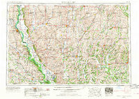
~ Nebraska City NE topo map, 1:250000 scale, 1 X 2 Degree, Historical, 1955, updated 1967
Nebraska City, Nebraska, USGS topographic map dated 1955.
Includes geographic coordinates (latitude and longitude). This topographic map is suitable for hiking, camping, and exploring, or framing it as a wall map.
Printed on-demand using high resolution imagery, on heavy weight and acid free paper, or alternatively on a variety of synthetic materials.
Topos available on paper, Waterproof, Poly, or Tyvek. Usually shipping rolled, unless combined with other folded maps in one order.
- Product Number: USGS-5575904
- Free digital map download (high-resolution, GeoPDF): Nebraska City, Nebraska (file size: 24 MB)
- Map Size: please refer to the dimensions of the GeoPDF map above
- Weight (paper map): ca. 55 grams
- Map Type: POD USGS Topographic Map
- Map Series: HTMC
- Map Verison: Historical
- Cell ID: 75003
- Scan ID: 325609
- Imprint Year: 1967
- Woodland Tint: Yes
- Edit Year: 1967
- Datum: Unstated
- Map Projection: Transverse Mercator
- Map published by United States Army Corps of Engineers
- Map published by United States Army
- Map Language: English
- Scanner Resolution: 600 dpi
- Map Cell Name: Nebraska City
- Grid size: 1 X 2 Degree
- Date on map: 1955
- Map Scale: 1:250000
- Geographical region: Nebraska, United States
Neighboring Maps:
All neighboring USGS topo maps are available for sale online at a variety of scales.
Spatial coverage:
Topo map Nebraska City, Nebraska, covers the geographical area associated the following places:
- Siloam Springs - Essex - Douglas - Cypress - Athens (historical) - Albany Junction - Rulo - Roberts Mobile Home Court - Dotham - Rea - Coburg - Craig - Lone Corner - Kent - Wanamaker - Paul - Nebraska City - Murray - Lone Star - Corning - Salem - Clarinda Junction (historical) - Archer (historical) - Rohrs - McPaul - High Creek - Winslow - Maryville - Sidney - Strahan - Whitten - Prohibition City - Nishnabotna - Whitesville - Verdon - Midway - Benton - Rosendale - Roseberry - Monastery - Clearfield - Imogene - Falls City - Southside Trailer Park - Farragut - Nida (historical) - Burr Oak - Shepard (historical) - McCurry - Ravenwood - Anderson - Iveyville - Corning - Napier - Maloy - Applewood Mobile Home Park - Johnson - Dayton (historical) - Shenandoah - Mount Waller - Fillmore - Arispe - Mortimer (historical) - Bushville - Evona - Northboro - Phelps City - Washington Center - Mount Pleasant - Howe - Humboldt - Salem Coffey P O and Station - Nodaway - Gaynor - Graham - Brooklyn - Holt - Williamsville (historical) - Henshaw - Yorktown - Effingham - College Springs - Iona City (historical) - Enyart - Hamburg - Straussville - Dawsonville - Solomon - Brock - Empire Prairie - Conception Junction - Bridgeport - King City - Platteville - White Cloud - Flag Springs - Berlin - Merle Junction - York - Glenrock
- Map Area ID: AREA4140-96-94
- Northwest corner Lat/Long code: USGSNW41-96
- Northeast corner Lat/Long code: USGSNE41-94
- Southwest corner Lat/Long code: USGSSW40-96
- Southeast corner Lat/Long code: USGSSE40-94
- Northern map edge Latitude: 41
- Southern map edge Latitude: 40
- Western map edge Longitude: -96
- Eastern map edge Longitude: -94


