
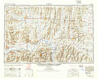
~ Moberly MO topo map, 1:250000 scale, 1 X 2 Degree, Historical, 1953, updated 1953
Moberly, Missouri, USGS topographic map dated 1953.
Includes geographic coordinates (latitude and longitude). This topographic map is suitable for hiking, camping, and exploring, or framing it as a wall map.
Printed on-demand using high resolution imagery, on heavy weight and acid free paper, or alternatively on a variety of synthetic materials.
Topos available on paper, Waterproof, Poly, or Tyvek. Usually shipping rolled, unless combined with other folded maps in one order.
- Product Number: USGS-5575898
- Free digital map download (high-resolution, GeoPDF): Moberly, Missouri (file size: 20 MB)
- Map Size: please refer to the dimensions of the GeoPDF map above
- Weight (paper map): ca. 55 grams
- Map Type: POD USGS Topographic Map
- Map Series: HTMC
- Map Verison: Historical
- Cell ID: 68916
- Scan ID: 325606
- Imprint Year: 1953
- Aerial Photo Year: 1941
- Datum: NAD27
- Map Projection: Transverse Mercator
- Map published by United States Geological Survey
- Map Language: English
- Scanner Resolution: 600 dpi
- Map Cell Name: Moberly
- Grid size: 1 X 2 Degree
- Date on map: 1953
- Map Scale: 1:250000
- Geographical region: Missouri, United States
Neighboring Maps:
All neighboring USGS topo maps are available for sale online at a variety of scales.
Spatial coverage:
Topo map Moberly, Missouri, covers the geographical area associated the following places:
- Walnut - Westville - Wabash Crossing - Gallatin - Woodlawn - Wheeling - Holliday - Wien - Asper - Larrabee - Snowdon (historical) - Salt Springs - Wilton Springs - Points (historical) - Ten Mile - Cowgill - Roads - Snow (historical) - Harkes - Cairo - Leverton - Browns - Longville (historical) - Sumner - Mandeville - Cuba (historical) - Sampsel - Latoh (historical) - Bynumville - Lexington - Cavendish - Higginsville - Nettleton - Bunker Hill - Cream Ridge - Saling - Heuer - Enterprise - Rockingham - Tina - Newhall - Estill - New Franklin - Mooresville - Fowkes - Huntsville - Avalon - De Witt - Clarence - Norborne - Aullville - Ryder - Excello - Chula - Guthridge - Hardeman - Catawba - Wellington - Kellerville - Cazzell - Persia (historical) - Lakeview - Seney - Hamilton - Blake - Atlanta - Little Compton - Lewis Mill - Roanoke - Judd - Dawn - Axtell - Bethel - Lisbon - Hybrid (historical) - Elmer - Fountain Grove - Breckenridge - Walkersville - Epworth - Fairville - Keytesville - Hamden - Boonesboro - Kellogg - Levick Mill - Black Oak - College Mound - Brookfield - Stet - Sturges - Meadville - Jacksonville - Triplett - Plymouth - Paris - Higbee - Malta Bend - Lakeland - Salisbury
- Map Area ID: AREA4039-94-92
- Northwest corner Lat/Long code: USGSNW40-94
- Northeast corner Lat/Long code: USGSNE40-92
- Southwest corner Lat/Long code: USGSSW39-94
- Southeast corner Lat/Long code: USGSSE39-92
- Northern map edge Latitude: 40
- Southern map edge Latitude: 39
- Western map edge Longitude: -94
- Eastern map edge Longitude: -92


