
~ Moberly MO topo map, 1:250000 scale, 1 X 2 Degree, Historical, 1954, updated 1969
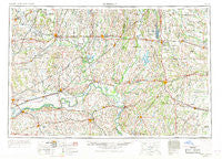
Moberly, Missouri, USGS topographic map dated 1954.
Includes geographic coordinates (latitude and longitude). This topographic map is suitable for hiking, camping, and exploring, or framing it as a wall map.
Printed on-demand using high resolution imagery, on heavy weight and acid free paper, or alternatively on a variety of synthetic materials.
Topos available on paper, Waterproof, Poly, or Tyvek. Usually shipping rolled, unless combined with other folded maps in one order.
- Product Number: USGS-5575892
- Free digital map download (high-resolution, GeoPDF): Moberly, Missouri (file size: 20 MB)
- Map Size: please refer to the dimensions of the GeoPDF map above
- Weight (paper map): ca. 55 grams
- Map Type: POD USGS Topographic Map
- Map Series: HTMC
- Map Verison: Historical
- Cell ID: 68916
- Scan ID: 325603
- Imprint Year: 1969
- Woodland Tint: Yes
- Edit Year: 1968
- Field Check Year: 1954
- Datum: Unstated
- Map Projection: Transverse Mercator
- Map published by United States Geological Survey
- Map published by: Military, Other
- Map Language: English
- Scanner Resolution: 600 dpi
- Map Cell Name: Moberly
- Grid size: 1 X 2 Degree
- Date on map: 1954
- Map Scale: 1:250000
- Geographical region: Missouri, United States
Neighboring Maps:
All neighboring USGS topo maps are available for sale online at a variety of scales.
Spatial coverage:
Topo map Moberly, Missouri, covers the geographical area associated the following places:
- Eversonville - Rockingham - Keytesville - Points (historical) - Goldsberry - Cottage - Middleton - Grace - Malta Bend - Excello - Eccles - Clarence - Breckenridge - New York - Waverly - Cunningham - Henrietta - Silverleaf - Blake - Longville (historical) - Lock Springs - Shelbina - Carrollton - Snow (historical) - Barryville - Bynumville - Dalton - Duncans Bridge - Ardmore - Boonesboro - Meadville - De Witt - Everett (historical) - Wheeling - Roanoke - Bloomington - Namrash (historical) - Corner Campbell School - Urbandale - Hubbard - Cherry Box - Chraneville (historical) - Coloma - Gilliam - Indian Grove - Bridge Creek - Cream Ridge - Herndon - South Carrollton - Oil City - Ash - Snyder - Salisbury - Lyda (historical) - Woodville - Orearville - Lingo - Chariton - Armstrong - Shoal - Richmond - Shelby - Wilton Springs - Petersburg - Wilhite (historical) - Mercyville - Fountain Grove - Leonard - New Franklin - Catawba - Mendon - Tabeau - Myrick - Norborne - Nettleton - Russellville - Hebron - Brookfield - Marshall - Cash - Granville - Hamilton - Macon - Saline City - Middle Grove - Fowkes - Nickellton - Cowgill - Hammack - Bonanza - Dawn - Kirby - Hatton - Sharon - Lakeland - Huntsville - Guthridge - Westville - Bosworth - Lebanon (historical)
- Map Area ID: AREA4039-94-92
- Northwest corner Lat/Long code: USGSNW40-94
- Northeast corner Lat/Long code: USGSNE40-92
- Southwest corner Lat/Long code: USGSSW39-94
- Southeast corner Lat/Long code: USGSSE39-92
- Northern map edge Latitude: 40
- Southern map edge Latitude: 39
- Western map edge Longitude: -94
- Eastern map edge Longitude: -92


