
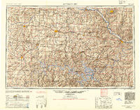
~ Jefferson City MO topo map, 1:250000 scale, 1 X 2 Degree, Historical, 1954, updated 1954
Jefferson City, Missouri, USGS topographic map dated 1954.
Includes geographic coordinates (latitude and longitude). This topographic map is suitable for hiking, camping, and exploring, or framing it as a wall map.
Printed on-demand using high resolution imagery, on heavy weight and acid free paper, or alternatively on a variety of synthetic materials.
Topos available on paper, Waterproof, Poly, or Tyvek. Usually shipping rolled, unless combined with other folded maps in one order.
- Product Number: USGS-5575856
- Free digital map download (high-resolution, GeoPDF): Jefferson City, Missouri (file size: 20 MB)
- Map Size: please refer to the dimensions of the GeoPDF map above
- Weight (paper map): ca. 55 grams
- Map Type: POD USGS Topographic Map
- Map Series: HTMC
- Map Verison: Historical
- Cell ID: 68843
- Scan ID: 325586
- Imprint Year: 1954
- Aerial Photo Year: 1944
- Datum: NAD27
- Map Projection: Transverse Mercator
- Map published by United States Army Corps of Engineers
- Map published by United States Army
- Map Language: English
- Scanner Resolution: 600 dpi
- Map Cell Name: Jefferson City
- Grid size: 1 X 2 Degree
- Date on map: 1954
- Map Scale: 1:250000
- Geographical region: Missouri, United States
Neighboring Maps:
All neighboring USGS topo maps are available for sale online at a variety of scales.
Spatial coverage:
Topo map Jefferson City, Missouri, covers the geographical area associated the following places:
- Moores Switch - Burlington (historical) - Centertown - Brandon - Scott - Howards Bluff (historical) - Venus - Stover - Lewis - Cape Galena (historical) - Maurine - Guthrie - Ninnescah Park - Fairfield (historical) - Mount Zion - Hoffman - Hartsburg - Cedar City - Lincoln - Shawnee Mound - Neongwah - White Cloud - Millbrook - Oldham - Big Bend Acres - Meta - Purvis - Four Seasons - Lindbergh - Decatur - Passover - Camdenton - Toronto - Racket - Dunksburg - Whitakerville - Watkins - Proctor - Pertle Springs - Tavern - Iuka Springs - Keethtown - Englewood - Osceola - Pleasant Green - Lakeview Heights - Hartwell - Old Chilhowee - Fristoe - Excelsior - Sedalia - Newland - Kaiser - Prairie Home - Sunrise Beach - Mount Pleasant - Schubert - Freedom - Finey - Boydsville - Barnumton - Copeland - Bowmansville - White Branch - Lake Ozark - Pierpont - Buck Creek - Spring Garden - Clifton City - Samtown - Phillips Ford (historical) - Cole Camp Junction - Pleasant Mount - Elkhurst - Shackleford Crossing - Olean - Jefferson City - Beaman - Rocheport - High Point - Linn Creek - Centerview - Pleasant Grove - La Due - Norris - Saint Anthony - Clinton - Jamestown - Osage City - Ginlet - Wardsville - Van Cleve - Dell Junction - Tipton - Nelson - Teal (historical) - Stringtown - Atwell - Alberta - Deepwater
- Map Area ID: AREA3938-94-92
- Northwest corner Lat/Long code: USGSNW39-94
- Northeast corner Lat/Long code: USGSNE39-92
- Southwest corner Lat/Long code: USGSSW38-94
- Southeast corner Lat/Long code: USGSSE38-92
- Northern map edge Latitude: 39
- Southern map edge Latitude: 38
- Western map edge Longitude: -94
- Eastern map edge Longitude: -92


