
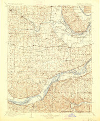
~ O Fallon MO topo map, 1:125000 scale, 30 X 30 Minute, Historical, 1903, updated 1927
O Fallon, Missouri, USGS topographic map dated 1903.
Includes geographic coordinates (latitude and longitude). This topographic map is suitable for hiking, camping, and exploring, or framing it as a wall map.
Printed on-demand using high resolution imagery, on heavy weight and acid free paper, or alternatively on a variety of synthetic materials.
Topos available on paper, Waterproof, Poly, or Tyvek. Usually shipping rolled, unless combined with other folded maps in one order.
- Product Number: USGS-5575760
- Free digital map download (high-resolution, GeoPDF): O Fallon, Missouri (file size: 9 MB)
- Map Size: please refer to the dimensions of the GeoPDF map above
- Weight (paper map): ca. 55 grams
- Map Type: POD USGS Topographic Map
- Map Series: HTMC
- Map Verison: Historical
- Cell ID: 66222
- Scan ID: 325539
- Imprint Year: 1927
- Survey Year: 1898
- Datum: NAD
- Map Projection: Polyconic
- Map published by United States Geological Survey
- Map Language: English
- Scanner Resolution: 600 dpi
- Map Cell Name: O'Fallon
- Grid size: 30 X 30 Minute
- Date on map: 1903
- Map Scale: 1:125000
- Geographical region: Missouri, United States
Neighboring Maps:
All neighboring USGS topo maps are available for sale online at a variety of scales.
Spatial coverage:
Topo map O Fallon, Missouri, covers the geographical area associated the following places:
- Highview (historical) - Wentzville - Hickory Hollow - Cimarron - Kampville - Golden Eagle - Ballwin - Winfield - Centerville - Saint Paul - Clarkson Valley - Winneberger - Mountain Ridge - Eureka - Matson - Stonemoor - Cottleville - Lincoln Beach - Owen (historical) - Dutzow - Foristell - Howell - Nona - Petersville - Chantilly (historical) - Josephville - Bellefontaine - Seeburger - Old Monroe - Brussels - Gumbo - Meppen - Tyson - Chain of Rocks - Cap au Gris - Pettys Hill - Jedburgh - Flint Hill - Cedar Bluff - Brevator - Dardenne - South Troy - Crescent - Augusta - Manchester - The Crossroads - Crystal Creek - Glencoe - Stevens - McCann Landing - Moscow Mills - Three Creeks Village - Howell (historical) - Dartmound (historical) - Boles - Firma - Femme Osage - Orrville - Yeatman - Pond - Grover - Ranken - Winchester - Centaur - Weldon Spring Heights - Peine Lake Estates - Loehr - Allenton - Timber Trace - Beechville - Morschels - Lake Saint Louis - Seebarger - Monarch - Defiance - Harvester - Conrad - Fountains at Bear Creek - Great Oaks - Troy - Times Beach (historical) - Klondike - Villages at Stonegate - Cappeln - Castlewood - Hamburg - Saint Albans - Highland Estates - Fountain N' Lakes - New Melle - Schluersburg - Chesterfield - Dardenne Prairie - Woodlands at Bear Creek - Jacobs - Melrose - Deer Plain - Saint Peters - All Saints Village - South Shore
- Map Area ID: AREA3938.5-91-90.5
- Northwest corner Lat/Long code: USGSNW39-91
- Northeast corner Lat/Long code: USGSNE39-90.5
- Southwest corner Lat/Long code: USGSSW38.5-91
- Southeast corner Lat/Long code: USGSSE38.5-90.5
- Northern map edge Latitude: 39
- Southern map edge Latitude: 38.5
- Western map edge Longitude: -91
- Eastern map edge Longitude: -90.5


