
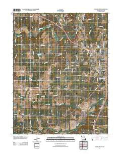
~ Sedalia West MO topo map, 1:24000 scale, 7.5 X 7.5 Minute, Historical, 2011
Sedalia West, Missouri, USGS topographic map dated 2011.
Includes geographic coordinates (latitude and longitude). This topographic map is suitable for hiking, camping, and exploring, or framing it as a wall map.
Printed on-demand using high resolution imagery, on heavy weight and acid free paper, or alternatively on a variety of synthetic materials.
Topos available on paper, Waterproof, Poly, or Tyvek. Usually shipping rolled, unless combined with other folded maps in one order.
- Product Number: USGS-5574044
- Free digital map download (high-resolution, GeoPDF): Sedalia West, Missouri (file size: 17 MB)
- Map Size: please refer to the dimensions of the GeoPDF map above
- Weight (paper map): ca. 55 grams
- Map Type: POD USGS Topographic Map
- Map Series: US Topo
- Map Verison: Historical
- Cell ID: 71549
- Datum: North American Datum of 1983
- Map Projection: Transverse Mercator
- Map Cell Name: Sedalia West
- Grid size: 7.5 X 7.5 Minute
- Date on map: 2011
- Map Scale: 1:24000
- Geographical region: Missouri, United States
Neighboring Maps:
All neighboring USGS topo maps are available for sale online at a variety of scales.
Spatial coverage:
Topo map Sedalia West, Missouri, covers the geographical area associated the following places:
- State Fair Community College - Lake Lucille - Memorial Park Cemetery - Homan Field - KMOS-TV (Sedalia) - Glover School (historical) - Parkhurst Lake Dam - Dresden Cemetery - E W Thompson School for the Handicapped - Quisenberry School (historical) - Pettis County - Coon Creek - Bradford Roadside Park - Pettis County Fire Protection District Station 1 - Township of Prairie - Camp Branch School (historical) - Brown School (historical) - Basin Fork - Elk Branch - Campbell Siding - McKee Chapel - Van Natta School (historical) - State Fairground Racetrack - Camp Branch - Anderson School (historical) - High Point School (historical) - Camp Branch - Camp Branch Church - Thompson Hills Shopping Center - Pettis County Elementary School - Oak Grove School (historical) - Skyline Elementary School - Sedalia Fire Department Headquarters Station - KDRO-AM (Sedalia) - Quisenberry Cemetery - State Fair Shopping Center - Walnut Hill Country Club - Department of Conservation Kansas City Regional Field Fire Office Sedalia
- Map Area ID: AREA38.7538.625-93.375-93.25
- Northwest corner Lat/Long code: USGSNW38.75-93.375
- Northeast corner Lat/Long code: USGSNE38.75-93.25
- Southwest corner Lat/Long code: USGSSW38.625-93.375
- Southeast corner Lat/Long code: USGSSE38.625-93.25
- Northern map edge Latitude: 38.75
- Southern map edge Latitude: 38.625
- Western map edge Longitude: -93.375
- Eastern map edge Longitude: -93.25


