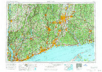
~ Hartford CT topo map, 1:250000 scale, 1 X 2 Degree, Historical, 1962, updated 1971
Hartford, Connecticut, USGS topographic map dated 1962.
Includes geographic coordinates (latitude and longitude). This topographic map is suitable for hiking, camping, and exploring, or framing it as a wall map.
Printed on-demand using high resolution imagery, on heavy weight and acid free paper, or alternatively on a variety of synthetic materials.
Topos available on paper, Waterproof, Poly, or Tyvek. Usually shipping rolled, unless combined with other folded maps in one order.
- Product Number: USGS-5566646
- Free digital map download (high-resolution, GeoPDF): Hartford, Connecticut (file size: 26 MB)
- Map Size: please refer to the dimensions of the GeoPDF map above
- Weight (paper map): ca. 55 grams
- Map Type: POD USGS Topographic Map
- Map Series: HTMC
- Map Verison: Historical
- Cell ID: 72228
- Scan ID: 331223
- Imprint Year: 1971
- Woodland Tint: Yes
- Aerial Photo Year: 1958
- Edit Year: 1969
- Field Check Year: 1962
- Datum: Unstated
- Map Projection: Transverse Mercator
- Map published by United States Geological Survey
- Map Language: English
- Scanner Resolution: 600 dpi
- Map Cell Name: Hartford
- Grid size: 1 X 2 Degree
- Date on map: 1962
- Map Scale: 1:250000
- Geographical region: Connecticut, United States
Neighboring Maps:
All neighboring USGS topo maps are available for sale online at a variety of scales.
Spatial coverage:
Topo map Hartford, Connecticut, covers the geographical area associated the following places:
- Fernwood Estates - Brockway Landing - West Ashford - Farmington Station - Hopeville - Fenwick - Greenacres - West Mahopac - Bishops Corner - Poquonock Bridge - Natchaug (historical) - Grand View-on-Hudson - Titusville - Fishers Island - Fenwood - Hockanum - Brooksvale - North Coventry - Redding - Peconic - Hazardville - Middle Haddam - Coachlight Village - South Nyack - Hoxie Corner - Hassunadchuauck (historical) - Spackenkill - Avon Park South - Showtucket (historical) - New Guinea (historical) - Shippan Point - Prospect - Chimney Point - Wapping Mews Elderly Housing - Heilwield Corner - Rawson - Bridgewater - Riverview Mobile Home Estates - Thomaston - Shenandoah - Hoskins - Haines Corners - Wolcott - Giants Neck - Ennis Mobile Home Park - Windmill Farm - Belle Haven - Lake Pocotopaug - Lake Carmel - Guilford - Southington - Spoonville (historical) - North Stamford - Murray - Tunxis Hill - Schoonhoven Park - Lomala - Barkhamsted - River Glen - Dutcher Mobile Home Park - Valhalla - New Canaan - Ossining - Knapps Corner - Danbury - Titicus - Tylerville - Backus Corner - Lydallville - Upper Merryall - East Plymouth - Cheshire - South Britain - Buckland - Huntington - Crotonville - Hillcrest - Duchess Park Mobile Home Park - Bunker Hill - Selleck Four Corners (historical) - Colebrook - Oswegatchie - Firetown - North Madison - Lyme Station - Salmon Brook - West Patterson - Wilson - South Chaplin - Baldwin Place - Rivercliff - Goodrichville - Beixedon Estates - Middletown - Pine Grove Terrace - Attawan Beach - Cedar Lake - Momauguin - Bristol - North Ashford
- Map Area ID: AREA4241-74-72
- Northwest corner Lat/Long code: USGSNW42-74
- Northeast corner Lat/Long code: USGSNE42-72
- Southwest corner Lat/Long code: USGSSW41-74
- Southeast corner Lat/Long code: USGSSE41-72
- Northern map edge Latitude: 42
- Southern map edge Latitude: 41
- Western map edge Longitude: -74
- Eastern map edge Longitude: -72