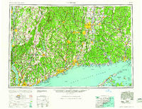
~ Hartford CT topo map, 1:250000 scale, 1 X 2 Degree, Historical, 1961, updated 1961
Hartford, Connecticut, USGS topographic map dated 1961.
Includes geographic coordinates (latitude and longitude). This topographic map is suitable for hiking, camping, and exploring, or framing it as a wall map.
Printed on-demand using high resolution imagery, on heavy weight and acid free paper, or alternatively on a variety of synthetic materials.
Topos available on paper, Waterproof, Poly, or Tyvek. Usually shipping rolled, unless combined with other folded maps in one order.
- Product Number: USGS-5566642
- Free digital map download (high-resolution, GeoPDF): Hartford, Connecticut (file size: 21 MB)
- Map Size: please refer to the dimensions of the GeoPDF map above
- Weight (paper map): ca. 55 grams
- Map Type: POD USGS Topographic Map
- Map Series: HTMC
- Map Verison: Historical
- Cell ID: 72228
- Scan ID: 331221
- Imprint Year: 1961
- Woodland Tint: Yes
- Aerial Photo Year: 1946
- Datum: Unstated
- Map Projection: Transverse Mercator
- Map published by United States Army Corps of Engineers
- Map published by United States Army
- Map Language: English
- Scanner Resolution: 600 dpi
- Map Cell Name: Hartford
- Grid size: 1 X 2 Degree
- Date on map: 1961
- Map Scale: 1:250000
- Geographical region: Connecticut, United States
Neighboring Maps:
All neighboring USGS topo maps are available for sale online at a variety of scales.
Spatial coverage:
Topo map Hartford, Connecticut, covers the geographical area associated the following places:
- Milltown - Oak Meadows Mobile Home Park - West Woodstock - Mansfield Depot - Stepney - Pachin Mills - Fogelmarks Corners - Forestville - Bolton - Brink's Trailer Park - Pine Grove - Durham Center - Sleightsburg - Archville - Mount Carmel - Milestone Corner - Bardonia - Kent Hills - Hidden Brook Estates Mobile Home Park - Bakersville - Seymour - Avery Corner - Irvington - Fosters Corners - Fernridge Place - Napeague - Willow Brook - Hebron - South Nyack - Oakdale - The Gables - Buckland - Valley Mobile Home Park - Crowleys Corner - Fox Hollow - East Mountain - Chester - Gilbert Corners - Point O'Woods - Westcott (historical) - Strawberry Acres Mobile Home Park - West Norwalk - North Branford - East Cutchogue - Natchaug (historical) - Bullet Hole - Lithgow - Hazardville - Wingdale - Burlington - Attlebury - Turkey Cobble - Newtown - Morris - Riveredge Trailer Park - Marble Dale - Bailey Beach - West Woods - Lime Rock - Winnipauk Village - Yalesville - Carroll Corners - Millbrook Heights - Gayville - Woodlands - East Kent - Fenwood - Terramuggus - Roxbury - Chappaqua - Bridgewater - Haviland - Tariffville Center - Redding - Tyler Lake Heights - Addison - Rocky Hill - Hungary - Spring Glen - Greenfield Hill - Carmel Park Estates - East Glastonbury - Bishops Corner - South Ellsworth - Chimney Corners - Candlewood Springs - Huckleberry Hills Trails - Lydallville - Saybrooke Village - Dempsey Landing - Lakewood - Pleasantville - Union - Sodom - Port Chester - Berlin - Old Avon Village - South Kent - Windham - Doanesburgh (historical)
- Map Area ID: AREA4241-74-72
- Northwest corner Lat/Long code: USGSNW42-74
- Northeast corner Lat/Long code: USGSNE42-72
- Southwest corner Lat/Long code: USGSSW41-74
- Southeast corner Lat/Long code: USGSSE41-72
- Northern map edge Latitude: 42
- Southern map edge Latitude: 41
- Western map edge Longitude: -74
- Eastern map edge Longitude: -72

