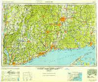
~ Hartford CT topo map, 1:250000 scale, 1 X 2 Degree, Historical, 1948
Hartford, Connecticut, USGS topographic map dated 1948.
Includes geographic coordinates (latitude and longitude). This topographic map is suitable for hiking, camping, and exploring, or framing it as a wall map.
Printed on-demand using high resolution imagery, on heavy weight and acid free paper, or alternatively on a variety of synthetic materials.
Topos available on paper, Waterproof, Poly, or Tyvek. Usually shipping rolled, unless combined with other folded maps in one order.
- Product Number: USGS-5566640
- Free digital map download (high-resolution, GeoPDF): Hartford, Connecticut (file size: 22 MB)
- Map Size: please refer to the dimensions of the GeoPDF map above
- Weight (paper map): ca. 55 grams
- Map Type: POD USGS Topographic Map
- Map Series: HTMC
- Map Verison: Historical
- Cell ID: 72228
- Scan ID: 331220
- Woodland Tint: Yes
- Aerial Photo Year: 1946
- Datum: NAD27
- Map Projection: Transverse Mercator
- Map published by United States Army Corps of Engineers
- Map published by United States Army
- Map Language: English
- Scanner Resolution: 600 dpi
- Map Cell Name: Hartford
- Grid size: 1 X 2 Degree
- Date on map: 1948
- Map Scale: 1:250000
- Geographical region: Connecticut, United States
Neighboring Maps:
All neighboring USGS topo maps are available for sale online at a variety of scales.
Spatial coverage:
Topo map Hartford, Connecticut, covers the geographical area associated the following places:
- Manchester Bridge - Taylor Corners - Shrub Oak - Allingtown - Stanwood - New London - South Norwalk - Higganum - Flanders - Bargytown - Saugatuck Shores - East Marion - Weatogue - North Cromwell - Spencer Corners - Southington - Stetson Corner - Gildersleeve - Meadowbrook - Black Rock - East Irvington - Birchwood - Hopeville - Peach Lake - Westville - Chatsworth Village - Ellithorpe - Huntersville (historical) - Versailles - New Hamburg - Ossining - Windsorville - Scovill Landing - Croton Falls - Amesville - Westford - Rawson - Robert Hutt Congregate Housing - Cedar Beach - Childrens Village of the Hartford Orphan Asylum - Knollwood - Gales Ferry - West Woodstock - Cornwall - Millbrook - Duchess Park Mobile Home Park - Hayden - Harwinton - East White Plains - Lakeridge Heights - Mitcheltown - Pine Bridge - Mount Airy - Fernridge Place - Grantville - Goodrichville - Hopewell Junction - Pootatuck Park - Greenfield Hill - Mudgetown - Hockanum - Candlewood Knolls - High Plains - Mount Parnassus - Pinneys Corners - Huntingtown - South Canaan - Old Greenwich - Burrville - Warren - Congers - Chaffeeville - Kelly Corner - Hortontown - Akins Corners - Lakeville - Smith Corner - Northvale - Clove Valley - Goodrich Heights - Bayview - Groton - Griswoldville - Bulls Bridge - Topstone - Fenwick - Shekomeko - East Morris - Whitehall Corners - South Salem - South Ellsworth - West Granby - Highland Park - Coventry - Heilwield Corner - Roxbury - Highland Falls - Spring Village - Farmington Station - Noroton
- Map Area ID: AREA4241-74-72
- Northwest corner Lat/Long code: USGSNW42-74
- Northeast corner Lat/Long code: USGSNE42-72
- Southwest corner Lat/Long code: USGSSW41-74
- Southeast corner Lat/Long code: USGSSE41-72
- Northern map edge Latitude: 42
- Southern map edge Latitude: 41
- Western map edge Longitude: -74
- Eastern map edge Longitude: -72