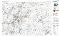
~ Hartford CT topo map, 1:100000 scale, 30 X 60 Minute, Historical, 1986, updated 1986
Hartford, Connecticut, USGS topographic map dated 1986.
Includes geographic coordinates (latitude and longitude). This topographic map is suitable for hiking, camping, and exploring, or framing it as a wall map.
Printed on-demand using high resolution imagery, on heavy weight and acid free paper, or alternatively on a variety of synthetic materials.
Topos available on paper, Waterproof, Poly, or Tyvek. Usually shipping rolled, unless combined with other folded maps in one order.
- Product Number: USGS-5566614
- Free digital map download (high-resolution, GeoPDF): Hartford, Connecticut (file size: 26 MB)
- Map Size: please refer to the dimensions of the GeoPDF map above
- Weight (paper map): ca. 55 grams
- Map Type: POD USGS Topographic Map
- Map Series: HTMC
- Map Verison: Historical
- Cell ID: 67643
- Scan ID: 331208
- Imprint Year: 1986
- Aerial Photo Year: 1979
- Edit Year: 1986
- Datum: NAD27
- Map Projection: Universal Transverse Mercator
- Planimetric: Yes
- Map published by United States Geological Survey
- Map Language: English
- Scanner Resolution: 600 dpi
- Map Cell Name: Hartford
- Grid size: 30 X 60 Minute
- Date on map: 1986
- Map Scale: 1:100000
- Geographical region: Connecticut, United States
Neighboring Maps:
All neighboring USGS topo maps are available for sale online at a variety of scales.
Spatial coverage:
Topo map Hartford, Connecticut, covers the geographical area associated the following places:
- Avery Corner - New Britain - Somersville - Vernon Center - Benvenue (historical) - East Farmington Heights - Oxford Park - East Windsor Hill - Hartford - Enfield - Taylor Town - North Windham - Prospect - Corbin Heights Housing - Newfield Heights - Glastonbury - Merrow - Wapping - Mansfield Four Corners - Somers - Wolcott - Bristol - Long HIll Estates - Hope Valley - Crowleys Corner - Goodrichville - Barber Corner (historical) - Simsbury - Rivermead Mobile Home Park - Milldale - Poquonock - Smith Tower Housing - Hanover - Highland Park - North Bloomfield - Tracy - Sherman Corner - Windermere - Unionville - Forest Village - Burnham - Mansfield City - Manchester - Mount Pleasant Housing - Windmill Springs - Deaconwood - Spoonville (historical) - Talcottville - Oxford Village - North Westchester - Newent - West Hartford - Fox Hollow - Mansfield Center - Spring Hill - Mount Hope - Versailles - Occum - River Glen - West Hill - Cobalt - Salmon Brook - Cherry Park - Pondside - North Franklin - Browns Corner - Abington - Bahre Corner - Hassunadchuauck (historical) - Franklin - Stillmans Corner - The Gables - Burlington - Cromwell Hills - Childrens Village of the Hartford Orphan Asylum - North Cromwell - Breakneck - Rainbow - Forbes Village - Windsorville - Meriden - Mansfield Depot - Cheshire Street (historical) - Westmoor Park - Avon Park South - Canton Valley - Lebanon - Columbia - Buckland - Thralltown - Farnhams - West Ashford - Coventry - Town Hill - Newington Junction - Taftville - West Cheshire - Chaplin - Hoskins - Mill Pond Village
- Map Area ID: AREA4241.5-73-72
- Northwest corner Lat/Long code: USGSNW42-73
- Northeast corner Lat/Long code: USGSNE42-72
- Southwest corner Lat/Long code: USGSSW41.5-73
- Southeast corner Lat/Long code: USGSSE41.5-72
- Northern map edge Latitude: 42
- Southern map edge Latitude: 41.5
- Western map edge Longitude: -73
- Eastern map edge Longitude: -72