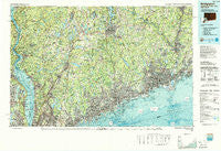
~ Bridgeport CT topo map, 1:100000 scale, 30 X 60 Minute, Historical, 1986, updated 1988
Bridgeport, Connecticut, USGS topographic map dated 1986.
Includes geographic coordinates (latitude and longitude). This topographic map is suitable for hiking, camping, and exploring, or framing it as a wall map.
Printed on-demand using high resolution imagery, on heavy weight and acid free paper, or alternatively on a variety of synthetic materials.
Topos available on paper, Waterproof, Poly, or Tyvek. Usually shipping rolled, unless combined with other folded maps in one order.
- Product Number: USGS-5566612
- Free digital map download (high-resolution, GeoPDF): Bridgeport, Connecticut (file size: 44 MB)
- Map Size: please refer to the dimensions of the GeoPDF map above
- Weight (paper map): ca. 55 grams
- Map Type: POD USGS Topographic Map
- Map Series: HTMC
- Map Verison: Historical
- Cell ID: 67182
- Scan ID: 331207
- Imprint Year: 1988
- Woodland Tint: Yes
- Aerial Photo Year: 1983
- Edit Year: 1986
- Datum: NAD27
- Map Projection: Universal Transverse Mercator
- Map published by United States Geological Survey
- Map Language: English
- Scanner Resolution: 600 dpi
- Map Cell Name: Bridgeport
- Grid size: 30 X 60 Minute
- Date on map: 1986
- Map Scale: 1:100000
- Geographical region: Connecticut, United States
Neighboring Maps:
All neighboring USGS topo maps are available for sale online at a variety of scales.
Spatial coverage:
Topo map Bridgeport, Connecticut, covers the geographical area associated the following places:
- Walnut Beach - Bigelow Corners - Ridgeway - New Fairfield - Forsonville - Lake Lucille - Bedford Center - Crompond - Elm Tree Corner - Carmel Park Estates - Kent Cliffs - Easton - Gilbert Corners - Baldwin Place - Sparkill - West Haverstraw - Riverbank - Candlewood Lake Club - Eastview - Steinbeck Corners - Redding - Brookfield Center - Pine Rock Park - Cedar Heights - Selleck Four Corners (historical) - Huntington - Oronoque Hills South - Union City - Northvale - Heritage Hills - Lake Carmel - Samsondale - Crugers - Shippan Point - Ossining - Southford - Silvermine - Pleasantville - Jefferson Valley - Northfield - Fox Hill - Fox Meadow - Quarry Heights - Nyack - Tomkins Cove - Hockanum Park (historical) - Mountain View Mobile Home Park - High Ridge - Annsville - Oregon - Woodbridge - Mahopac - Gilbert Corners - McKeel Corners - Plattsville - Sellecks Corners - Kinneytown - Round Beach - Piermont - North Castle - Stanwood - Dennytown - Old Greenwich - Kirbyville - Fosters Corners - Stanwich - East Village - Whitehall Corners - Millwood - Tappan - Sandy Hook - Goldens Bridge - Wataba Lake - Nichols - Thornwood - Miry Brook - Battle Hill - Cedar Beach - Knolls Trailer Court - Ridgebury - Glendale - Cranbury - Trumbull - Newfield - Graham - Palestine - Shorehaven - Glenbrook - Tompkins Corners - Verplanck - Belltown - Haviland Hollow - Noroton Heights - Oakdale Manor - Straitsville - Little Danbury (historical) - Scotts Corners - Saint Josephs Village - South Salem - Hopewell
- Map Area ID: AREA41.541-74-73
- Northwest corner Lat/Long code: USGSNW41.5-74
- Northeast corner Lat/Long code: USGSNE41.5-73
- Southwest corner Lat/Long code: USGSSW41-74
- Southeast corner Lat/Long code: USGSSE41-73
- Northern map edge Latitude: 41.5
- Southern map edge Latitude: 41
- Western map edge Longitude: -74
- Eastern map edge Longitude: -73