~ Bridgeport CT topo map, 1:100000 scale, 30 X 60 Minute, Historical, 1986, updated 1988
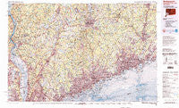
Bridgeport, Connecticut, USGS topographic map dated 1986.
Includes geographic coordinates (latitude and longitude). This topographic map is suitable for hiking, camping, and exploring, or framing it as a wall map.
Printed on-demand using high resolution imagery, on heavy weight and acid free paper, or alternatively on a variety of synthetic materials.
Topos available on paper, Waterproof, Poly, or Tyvek. Usually shipping rolled, unless combined with other folded maps in one order.
- Product Number: USGS-5566608
- Free digital map download (high-resolution, GeoPDF): Bridgeport, Connecticut (file size: 41 MB)
- Map Size: please refer to the dimensions of the GeoPDF map above
- Weight (paper map): ca. 55 grams
- Map Type: POD USGS Topographic Map
- Map Series: HTMC
- Map Verison: Historical
- Cell ID: 67182
- Scan ID: 330422
- Imprint Year: 1988
- Woodland Tint: Yes
- Visual Version Number: 2
- Aerial Photo Year: 1983
- Edit Year: 1986
- Datum: NAD27
- Map Projection: Universal Transverse Mercator
- Map published by United States Geological Survey
- Map Language: English
- Scanner Resolution: 600 dpi
- Map Cell Name: Bridgeport
- Grid size: 30 X 60 Minute
- Date on map: 1986
- Map Scale: 1:100000
- Geographical region: Connecticut, United States
Neighboring Maps:
All neighboring USGS topo maps are available for sale online at a variety of scales.
Spatial coverage:
Topo map Bridgeport, Connecticut, covers the geographical area associated the following places:
- Fairfield - Valhalla - Devon - North Wilton - Compo - Winnipauk - Huntingtown - Beaverbrook - Hale Court - Piermont - Black Rock - Amawalk - Boutonville - Bullet Hole - Lake Lincolndale - East Port Chester (historical) - Glenbrook - Croton-on-Hudson - Goldens Bridge - Kent Corners - Bedford Center - Greenacres - Whitehall Corners - Jefferson Valley - Bethel - Crofts Corners - West Norwalk - McKeel Corners - Little Danbury - Nelson Corners - Cold Spring - Titicus - Twin Lakes Village - Chappaqua - Richardsville - City of Milford (balance) - Candlewood Lake Club - Montrose - Fort Clinton - Jefferson Village - Granite Springs - Brownsell Corner - Kinneytown - Rye Brook - Toddville - Pine Bridge - North Mianus - Topstone - Bayview - Ardsley-on-Hudson - Philipse Manor - Armonk - Shrub Oak - Steinbeck Corners - Lattins Landing - Nelsonville - Ardsley - Bridgeport - Grand View-on-Hudson - West Seymour - Furnace Woods - Sarles Corners - Sparkill - Garrison - Shady Rest - North White Plains - Quarry Heights - Valleyville - Durant - Wilton - McLaughlin Acres - Horseshoe Hill - West Norwood - New City - Boston - Shelton - Manhattan Park - Valley Cottage - Silver Beach - White Plains - Archville - Beckettville - Nauraushaun - Pinneys Corners - High Ridge - Meads Corners - Doanesburgh (historical) - Mariandale - Pecks Mill - South End - Pleasant Acres - Wataba Lake - Blauvelt - Pine Hill - Nichols - Mianus - Deforest Corners - Baldwin Place - Brewster Hill - Lake Lucille
- Map Area ID: AREA41.541-74-73
- Northwest corner Lat/Long code: USGSNW41.5-74
- Northeast corner Lat/Long code: USGSNE41.5-73
- Southwest corner Lat/Long code: USGSSW41-74
- Southeast corner Lat/Long code: USGSSE41-73
- Northern map edge Latitude: 41.5
- Southern map edge Latitude: 41
- Western map edge Longitude: -74
- Eastern map edge Longitude: -73