
~ Sioux City IA topo map, 1:250000 scale, 1 X 2 Degree, Historical, 1955, updated 1959
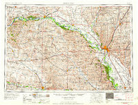
Sioux City, Iowa, USGS topographic map dated 1955.
Includes geographic coordinates (latitude and longitude). This topographic map is suitable for hiking, camping, and exploring, or framing it as a wall map.
Printed on-demand using high resolution imagery, on heavy weight and acid free paper, or alternatively on a variety of synthetic materials.
Topos available on paper, Waterproof, Poly, or Tyvek. Usually shipping rolled, unless combined with other folded maps in one order.
- Product Number: USGS-5564118
- Free digital map download (high-resolution, GeoPDF): Sioux City, Iowa (file size: 24 MB)
- Map Size: please refer to the dimensions of the GeoPDF map above
- Weight (paper map): ca. 55 grams
- Map Type: POD USGS Topographic Map
- Map Series: HTMC
- Map Verison: Historical
- Cell ID: 69032
- Scan ID: 317954
- Imprint Year: 1959
- Woodland Tint: Yes
- Field Check Year: 1955
- Datum: Unstated
- Map Projection: Transverse Mercator
- Map published by United States Army Corps of Engineers
- Map published by United States Army
- Map Language: English
- Scanner Resolution: 600 dpi
- Map Cell Name: Sioux City
- Grid size: 1 X 2 Degree
- Date on map: 1955
- Map Scale: 1:250000
- Geographical region: Iowa, United States
Neighboring Maps:
All neighboring USGS topo maps are available for sale online at a variety of scales.
Spatial coverage:
Topo map Sioux City, Iowa, covers the geographical area associated the following places:
- Glen Ellen - Northshore Development - Martinsburg - Yeomans - Covington (historical) - Spink - Mammen - Midland - Newcastle - Adaville - Bow Valley Mills - Junction City - Wren - Creighton - Basford (historical) - Homer - Waterbury - West Le Mars - Owego - Rosalie - Carroll - Luton - Brunswick - South Sioux City - Allen - Center - Thurston - Ponca - Tewsville - Whiting - Laurel - Oyens - Norfolk Mobile Home Community - Merrill - McKays Trailer Court - Magnet - Winnetoon - Hoffmans Trailer Court - Burbank - Craig - Dakota Dunes - Chatsworth - Altona - Fordyce - Concord - Brunsville - Sholes - Meckling - Greenfield - Estates West - Lodi - Moville - Holiday Village - Evergreen Village - Big Springs - Running Water - Gayville - Albaton - Walthill - Alsen - Alton - Hartington - West Randolph (historical) - Coleridge - Neptune - Saybrook (historical) - Carnes - Volin - Aten - McNally - Akron - Climbing Hill - Plymouth (historical) - North Shore - Marshalltown (historical) - Springfield - Bancroft - Saint James - Pierce - Clay Point - Bloomfield - Obert - Lakeport - Ionia (historical) - Emmet - Freeway Homes - Winnebago - Armel Acres Mobile Home Estates - Regency of Sioux City - Bloomingdale - Potosia - Jefferson - Wakefield - Nora - Sioux City - Hubbard - Kingsburg - Willis - James - Fairview Heights
- Map Area ID: AREA4342-98-96
- Northwest corner Lat/Long code: USGSNW43-98
- Northeast corner Lat/Long code: USGSNE43-96
- Southwest corner Lat/Long code: USGSSW42-98
- Southeast corner Lat/Long code: USGSSE42-96
- Northern map edge Latitude: 43
- Southern map edge Latitude: 42
- Western map edge Longitude: -98
- Eastern map edge Longitude: -96


