
~ O Neill NE topo map, 1:250000 scale, 1 X 2 Degree, Historical, 1959, updated 1959
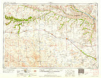
O Neill, Nebraska, USGS topographic map dated 1959.
Includes geographic coordinates (latitude and longitude). This topographic map is suitable for hiking, camping, and exploring, or framing it as a wall map.
Printed on-demand using high resolution imagery, on heavy weight and acid free paper, or alternatively on a variety of synthetic materials.
Topos available on paper, Waterproof, Poly, or Tyvek. Usually shipping rolled, unless combined with other folded maps in one order.
- Product Number: USGS-5564102
- Free digital map download (high-resolution, GeoPDF): O Neill, Nebraska (file size: 19 MB)
- Map Size: please refer to the dimensions of the GeoPDF map above
- Weight (paper map): ca. 55 grams
- Map Type: POD USGS Topographic Map
- Map Series: HTMC
- Map Verison: Historical
- Cell ID: 68942
- Scan ID: 317946
- Imprint Year: 1959
- Woodland Tint: Yes
- Field Check Year: 1955
- Datum: Unstated
- Map Projection: Transverse Mercator
- Map published by United States Army Corps of Engineers
- Map published by United States Army
- Map Language: English
- Scanner Resolution: 600 dpi
- Map Cell Name: O'Neill
- Grid size: 1 X 2 Degree
- Date on map: 1959
- Map Scale: 1:250000
- Geographical region: Nebraska, United States
Neighboring Maps:
All neighboring USGS topo maps are available for sale online at a variety of scales.
Spatial coverage:
Topo map O Neill, Nebraska, covers the geographical area associated the following places:
- Greenwood - Springview - Bassett - Deloit - Stuart - Dukeville - Cleveland (historical) - Sybrant - Perkins - Dustin - Opportunity - O'Neill - Paddock - Butte - Niobrara - Dyer - Kaup Trailer Court - Gross - Amelia - Newport - Swan Lake - Orchard - Burton - Neligh - Verdigre - Jamison - Rosedale (historical) - Star - Brocksburg - Venus - Johnsons Corner - Dorsey - Anncar - Raven - McDonalds Trailer Court - Inez - Ewing - Mariaville - Duff - Riverview - Pishelville - Clearwater - Page - Verdel - Atkinson - Stafford - Jelen - Long Pine - Inman - Meadville - Monowi - Naper - Catalpa - Bristow - Walnut - Wilson Ranch - Chambers - Meek - Zaks Trailer Court - Rose - Marty - Lynch - Redbird - Anoka - Midway - Mills - Ponca - Royal - Winfield (historical) - Emmet - Sandridge - Kipples Trailer Court - Douthit Trailer Court - Baker (historical) - Waymanns Trailer Court - Spencer - Ainsworth - Knievels Corner - Carns (historical) - Knoxville
- Map Area ID: AREA4342-100-98
- Northwest corner Lat/Long code: USGSNW43-100
- Northeast corner Lat/Long code: USGSNE43-98
- Southwest corner Lat/Long code: USGSSW42-100
- Southeast corner Lat/Long code: USGSSE42-98
- Northern map edge Latitude: 43
- Southern map edge Latitude: 42
- Western map edge Longitude: -100
- Eastern map edge Longitude: -98


