
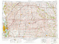
~ Omaha NE topo map, 1:250000 scale, 1 X 2 Degree, Historical, 1954, updated 1976
Omaha, Nebraska, USGS topographic map dated 1954.
Includes geographic coordinates (latitude and longitude). This topographic map is suitable for hiking, camping, and exploring, or framing it as a wall map.
Printed on-demand using high resolution imagery, on heavy weight and acid free paper, or alternatively on a variety of synthetic materials.
Topos available on paper, Waterproof, Poly, or Tyvek. Usually shipping rolled, unless combined with other folded maps in one order.
- Product Number: USGS-5564100
- Free digital map download (high-resolution, GeoPDF): Omaha, Nebraska (file size: 24 MB)
- Map Size: please refer to the dimensions of the GeoPDF map above
- Weight (paper map): ca. 55 grams
- Map Type: POD USGS Topographic Map
- Map Series: HTMC
- Map Verison: Historical
- Cell ID: 68948
- Scan ID: 317945
- Imprint Year: 1976
- Woodland Tint: Yes
- Aerial Photo Year: 1973
- Edit Year: 1974
- Datum: Unstated
- Map Projection: Transverse Mercator
- Map published by United States Geological Survey
- Map published by: Military, Other
- Map Language: English
- Scanner Resolution: 600 dpi
- Map Cell Name: Omaha
- Grid size: 1 X 2 Degree
- Date on map: 1954
- Map Scale: 1:250000
- Geographical region: Nebraska, United States
Neighboring Maps:
All neighboring USGS topo maps are available for sale online at a variety of scales.
Spatial coverage:
Topo map Omaha, Nebraska, covers the geographical area associated the following places:
- Carrollton - Redfield - North Branch - Frankfort (historical) - Gilmore Junction - Kimballton - Red Line - Menlo - Dickieville - Manning - Euclid - Calhoun - Bouton - Queen City (historical) - Grable - Logan - Plattsmouth - Bellevue - Larland - Quarry - Carbon - Henderson - Jacksonville - Overland Mobile Home Park - Kennedy - Kenfield - Quick - Wales - Sands Trailer Park - Rippey - Elliott - Winterset - Linden - HiVue Mobile Home Park - Howe - Beebeetown - Washington Mobile Home Terrace - Botna - Green Acres Mobile Home Park - Quincy - Dexter - Linwood - Minburn - Rumsey - Garretville - Gardiner - Magill - Wooded Lake Mobile Home Park - Lincoln Center - Orton - Pacific City - Cromwell - Beechwood - Adair - Nashville - Woodbine - Hard Scratch - Arbor Hill - Williamson - Barney - Berkley - Clucas - Harlan Trailer Court - Wiota - Haley - Glendon - Bridgewater - Viola Center - Carter Lake - Green Brier - Hamlin - Mount Etna - Kemling (historical) - Atlantic - Villa Village Mobile Home Park - Dow City - Angus - Oakland - Westridge Mobile Home Park - Country Court Mobile Home Park - Magnolia - Casey - Crisp - Avery - Pitzer - Tenville - Paradise Park - Pisgah - Irwin - Bentley - Orient - Dedham - Hill City Mobile Home Park - Moorhead - McClelland - Webster - Creston - Taylor - Ord - Weston
- Map Area ID: AREA4241-96-94
- Northwest corner Lat/Long code: USGSNW42-96
- Northeast corner Lat/Long code: USGSNE42-94
- Southwest corner Lat/Long code: USGSSW41-96
- Southeast corner Lat/Long code: USGSSE41-94
- Northern map edge Latitude: 42
- Southern map edge Latitude: 41
- Western map edge Longitude: -96
- Eastern map edge Longitude: -94


