
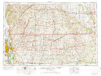
~ Omaha NE topo map, 1:250000 scale, 1 X 2 Degree, Historical, 1954, updated 1974
Omaha, Nebraska, USGS topographic map dated 1954.
Includes geographic coordinates (latitude and longitude). This topographic map is suitable for hiking, camping, and exploring, or framing it as a wall map.
Printed on-demand using high resolution imagery, on heavy weight and acid free paper, or alternatively on a variety of synthetic materials.
Topos available on paper, Waterproof, Poly, or Tyvek. Usually shipping rolled, unless combined with other folded maps in one order.
- Product Number: USGS-5564096
- Free digital map download (high-resolution, GeoPDF): Omaha, Nebraska (file size: 24 MB)
- Map Size: please refer to the dimensions of the GeoPDF map above
- Weight (paper map): ca. 55 grams
- Map Type: POD USGS Topographic Map
- Map Series: HTMC
- Map Verison: Historical
- Cell ID: 68948
- Scan ID: 317943
- Imprint Year: 1974
- Woodland Tint: Yes
- Edit Year: 1966
- Field Check Year: 1954
- Datum: Unstated
- Map Projection: Transverse Mercator
- Map published by United States Army Corps of Engineers
- Map published by United States Army
- Map Language: English
- Scanner Resolution: 600 dpi
- Map Cell Name: Omaha
- Grid size: 1 X 2 Degree
- Date on map: 1954
- Map Scale: 1:250000
- Geographical region: Nebraska, United States
Neighboring Maps:
All neighboring USGS topo maps are available for sale online at a variety of scales.
Spatial coverage:
Topo map Omaha, Nebraska, covers the geographical area associated the following places:
- Dumfries - Elk Horn - Perry Yard - East Omaha - Willey - Manilla - Carter Lake - Home Park - Sycamore Village - Canby - Afton - Cooper - Harrison - Carbon - Lake Panorama - Nishna - Peter - Echo - Garden Valley Courts - Barney - Morton Mills - Honey Creek - Fort Crook - Missouri Valley - Silver City - Shelby - Manteno - Union Burg (historical) - Treynor - Golden Spike Mobile Home Park - Yale - Black Corners - Wallin - Council Bluffs - Oreapolis - Clucas - Poplar - Prescott - Euclid - Persia - Afton Junction (historical) - Washington Mobile Home Terrace - Ascot - Wooded Lake Mobile Home Park - Stennett - Mineola - Willett - Westphalia - Zion - Carson - Mills - Soldier - Howe - McPherson - Harlan Junction (historical) - Prussia - Talmage - Bar-Jac Mobile Estates - Linden - Panora - Rippey - Crisp - Webster - Nevinville - Yorkshire - Berkley - Underwood - Findley - Avery - Malvern - Newtown (historical) - Dewey - Town and Country Mobile Homes - Botna - Paradise Park - Hawthorne - Ross - Orson - Norway Center - Lincoln Center - Rumsey - Magill - Biddick (historical) - Ord - Manning - Adair - Tennant - Orton - Pacific Junction - Harlan - Fiscus - Rorbeck - Dale - Loveland - Audubon - Diamondhead Lake - East Creston - Astor - Calhoun - Hastings
- Map Area ID: AREA4241-96-94
- Northwest corner Lat/Long code: USGSNW42-96
- Northeast corner Lat/Long code: USGSNE42-94
- Southwest corner Lat/Long code: USGSSW41-96
- Southeast corner Lat/Long code: USGSSE41-94
- Northern map edge Latitude: 42
- Southern map edge Latitude: 41
- Western map edge Longitude: -96
- Eastern map edge Longitude: -94


