
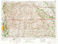
~ Omaha NE topo map, 1:250000 scale, 1 X 2 Degree, Historical, 1954, updated 1967
Omaha, Nebraska, USGS topographic map dated 1954.
Includes geographic coordinates (latitude and longitude). This topographic map is suitable for hiking, camping, and exploring, or framing it as a wall map.
Printed on-demand using high resolution imagery, on heavy weight and acid free paper, or alternatively on a variety of synthetic materials.
Topos available on paper, Waterproof, Poly, or Tyvek. Usually shipping rolled, unless combined with other folded maps in one order.
- Product Number: USGS-5564094
- Free digital map download (high-resolution, GeoPDF): Omaha, Nebraska (file size: 24 MB)
- Map Size: please refer to the dimensions of the GeoPDF map above
- Weight (paper map): ca. 55 grams
- Map Type: POD USGS Topographic Map
- Map Series: HTMC
- Map Verison: Historical
- Cell ID: 68948
- Scan ID: 317942
- Imprint Year: 1967
- Woodland Tint: Yes
- Aerial Photo Year: 1950
- Edit Year: 1966
- Field Check Year: 1954
- Datum: Unstated
- Map Projection: Transverse Mercator
- Map published by United States Army Corps of Engineers
- Map published by United States Army
- Map Language: English
- Scanner Resolution: 600 dpi
- Map Cell Name: Omaha
- Grid size: 1 X 2 Degree
- Date on map: 1954
- Map Scale: 1:250000
- Geographical region: Nebraska, United States
Neighboring Maps:
All neighboring USGS topo maps are available for sale online at a variety of scales.
Spatial coverage:
Topo map Omaha, Nebraska, covers the geographical area associated the following places:
- Missouri Valley - Grable - Bentley - Hentons (historical) - Pacific City - Fisk - Macksburg - Nanito - Hastings - Underwood - Neola - Gilmore - Berea - Crescent - Diamondhead Lake - Mineola - Stennett - Exira - Panther - Country Estates Mobile Home Park - Manteno - De Soto - Carl - Willey - Grove City (historical) - Home Park - Silver City - Norway Center - Cooper - Rosserdale - Talmage - Golden Spike Mobile Home Park - Astor - Peter - Echo - Country Court Mobile Home Park - Stuart - Clucas - Guthrie Center - Grant - Harlan Trailer Court - Weston - Sycamore Village - Panama - Dickieville - Pacific Junction - Quincy - Plattsmouth - Oreapolis - Beebeetown - Clara - Harrison - Magnolia - Menlo - Carbon - Garden Valley Courts - Chautauqua - South Omaha - Kimballton - Irwin - Winkelmans - Manilla - Garretville - Barney - Quarry - Massena - Casey - Herndon - Shelby - Emerson - Pisgah - Botna - Cromwell - Lemont (historical) - Manning - Defiance - Quick - Kirkman - Buck Grove - Kenfield - Creston - Treynor - Folsom - Jamaica - Findley - Perry Yard - Lake Panorama - Dedham - Macedonia - Adair - Webster - Mills - Viola Center - Panora - Hawthorne - Bellevue - Dewey - Earlham - HiVue Mobile Home Park - Perry
- Map Area ID: AREA4241-96-94
- Northwest corner Lat/Long code: USGSNW42-96
- Northeast corner Lat/Long code: USGSNE42-94
- Southwest corner Lat/Long code: USGSSW41-96
- Southeast corner Lat/Long code: USGSSE41-94
- Northern map edge Latitude: 42
- Southern map edge Latitude: 41
- Western map edge Longitude: -96
- Eastern map edge Longitude: -94


