
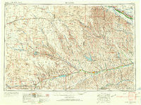
~ McCook NE topo map, 1:250000 scale, 1 X 2 Degree, Historical, 1954, updated 1966
McCook, Nebraska, USGS topographic map dated 1954.
Includes geographic coordinates (latitude and longitude). This topographic map is suitable for hiking, camping, and exploring, or framing it as a wall map.
Printed on-demand using high resolution imagery, on heavy weight and acid free paper, or alternatively on a variety of synthetic materials.
Topos available on paper, Waterproof, Poly, or Tyvek. Usually shipping rolled, unless combined with other folded maps in one order.
- Product Number: USGS-5564072
- Free digital map download (high-resolution, GeoPDF): McCook, Nebraska (file size: 20 MB)
- Map Size: please refer to the dimensions of the GeoPDF map above
- Weight (paper map): ca. 55 grams
- Map Type: POD USGS Topographic Map
- Map Series: HTMC
- Map Verison: Historical
- Cell ID: 68901
- Scan ID: 317931
- Imprint Year: 1966
- Woodland Tint: Yes
- Aerial Photo Year: 1953
- Edit Year: 1966
- Field Check Year: 1954
- Datum: Unstated
- Map Projection: Transverse Mercator
- Map published by United States Army Corps of Engineers
- Map published by United States Army
- Map Language: English
- Scanner Resolution: 600 dpi
- Map Cell Name: McCook
- Grid size: 1 X 2 Degree
- Date on map: 1954
- Map Scale: 1:250000
- Geographical region: Nebraska, United States
Neighboring Maps:
All neighboring USGS topo maps are available for sale online at a variety of scales.
Spatial coverage:
Topo map McCook, Nebraska, covers the geographical area associated the following places:
- Farnam - Indianola - Carmans Mobile Park - Somerset - Smith Trailer Court - Lamont - Benkelman - Stratton - Winters Mobile Home Park - Gothenburg - Rainbow Fountain Park - Willow Island - Lebanon - Madrid - Brandon - Palisade - Lamar - Merklin Trailer Court - Imperial - McCook - Haigler - Wauneta - Grant - Beverly - Trenton - Champion - Wellfleet - Bartley - Imperial Capitol Mobile Court - Marion - Shippee - Hamlet - Orafino - Elsie - Culbertson - Max - Wilsonville - Chase - Danbury - Youngs Trailer Court - Quick - Wallace - Stockville - Grainton - Dickens - Holbrook - Vroman - Cambridge - Cornell (historical) - Red Willow - Marengo - Maywood - Lazy L Mobile Ranch - Wilcox Trailer Court - Ough - Perry - Freedom - Moorefield - Triple C Trailer Court - Hayes Center - Parks - Curtis - Enders - Eustis - Crete - Baney Trailer Park
- Map Area ID: AREA4140-102-100
- Northwest corner Lat/Long code: USGSNW41-102
- Northeast corner Lat/Long code: USGSNE41-100
- Southwest corner Lat/Long code: USGSSW40-102
- Southeast corner Lat/Long code: USGSSE40-100
- Northern map edge Latitude: 41
- Southern map edge Latitude: 40
- Western map edge Longitude: -102
- Eastern map edge Longitude: -100


