
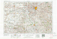
~ Lincoln NE topo map, 1:250000 scale, 1 X 2 Degree, Historical, 1955, updated 1967
Lincoln, Nebraska, USGS topographic map dated 1955.
Includes geographic coordinates (latitude and longitude). This topographic map is suitable for hiking, camping, and exploring, or framing it as a wall map.
Printed on-demand using high resolution imagery, on heavy weight and acid free paper, or alternatively on a variety of synthetic materials.
Topos available on paper, Waterproof, Poly, or Tyvek. Usually shipping rolled, unless combined with other folded maps in one order.
- Product Number: USGS-5564058
- Free digital map download (high-resolution, GeoPDF): Lincoln, Nebraska (file size: 21 MB)
- Map Size: please refer to the dimensions of the GeoPDF map above
- Weight (paper map): ca. 55 grams
- Map Type: POD USGS Topographic Map
- Map Series: HTMC
- Map Verison: Historical
- Cell ID: 68876
- Scan ID: 317924
- Imprint Year: 1967
- Woodland Tint: Yes
- Edit Year: 1966
- Field Check Year: 1955
- Datum: Unstated
- Map Projection: Transverse Mercator
- Map published by United States Army Corps of Engineers
- Map published by United States Army
- Map Language: English
- Scanner Resolution: 600 dpi
- Map Cell Name: Lincoln
- Grid size: 1 X 2 Degree
- Date on map: 1955
- Map Scale: 1:250000
- Geographical region: Nebraska, United States
Neighboring Maps:
All neighboring USGS topo maps are available for sale online at a variety of scales.
Spatial coverage:
Topo map Lincoln, Nebraska, covers the geographical area associated the following places:
- Powell - Gladstone - Elmwood - Gilead - Mission (historical) - Edgar - Hampton - Otoe - Greenwood - Utica - Bower (historical) - Mapps - Malcolm - Lewiston - McCool Junction - Armour (historical) - Tecumseh - Cio (historical) - Stoddard (historical) - Mayberry - Cordova - Odell - Du Bois - Beaver Crossing - Martland - Strang - Raymond - Saint Mary - Blue Springs - Yankee Hill - Wilber - Douglas - Pella (historical) - Palmyra - Byron - Sawyer (historical) - Bixby - Grover - Emerald - Oak Mill - Steele City - Tamora - Hoyle North 77 Mobile Homes - Violet (historical) - Bradshaw - Exeter - College View - Delta (historical) - Jansen - Syracuse - Havelock - Harbour West Mobile Home Park - Crab Orchard - Fairbury - Graf (historical) - Garland - Clatonia - Davey - Hebron - Carlisle - Shickley - Filley - Beatrice - Ellis - Waverly - Martell - Avoca - Grafton - Centerville - Shady Elm Mobile Home Park - Talmage - Hubbell - Harbine - Jamaica - Princeton - Saltillo - Hickman - Arbor - Geneva - Cook - Angus - Chester - Sutton - Mark IV Estates - Denton - Rockford - Virginia - Saronville - Twin Oaks Mobile Park - Dorchester - Milford - Roca - Holmesville - Ohiowa - Waco - Adams - West O Trailer Park - Burress - Stockham - Barneston
- Map Area ID: AREA4140-98-96
- Northwest corner Lat/Long code: USGSNW41-98
- Northeast corner Lat/Long code: USGSNE41-96
- Southwest corner Lat/Long code: USGSSW40-98
- Southeast corner Lat/Long code: USGSSE40-96
- Northern map edge Latitude: 41
- Southern map edge Latitude: 40
- Western map edge Longitude: -98
- Eastern map edge Longitude: -96


