
~ Broken Bow NE topo map, 1:250000 scale, 1 X 2 Degree, Historical, 1955
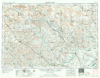
Broken Bow, Nebraska, USGS topographic map dated 1955.
Includes geographic coordinates (latitude and longitude). This topographic map is suitable for hiking, camping, and exploring, or framing it as a wall map.
Printed on-demand using high resolution imagery, on heavy weight and acid free paper, or alternatively on a variety of synthetic materials.
Topos available on paper, Waterproof, Poly, or Tyvek. Usually shipping rolled, unless combined with other folded maps in one order.
- Product Number: USGS-5564032
- Free digital map download (high-resolution, GeoPDF): Broken Bow, Nebraska (file size: 20 MB)
- Map Size: please refer to the dimensions of the GeoPDF map above
- Weight (paper map): ca. 55 grams
- Map Type: POD USGS Topographic Map
- Map Series: HTMC
- Map Verison: Historical
- Cell ID: 68691
- Scan ID: 317911
- Woodland Tint: Yes
- Field Check Year: 1955
- Datum: Unstated
- Map Projection: Transverse Mercator
- Map published by United States Army Corps of Engineers
- Map published by United States Army
- Map Language: English
- Scanner Resolution: 600 dpi
- Map Cell Name: Broken Bow
- Grid size: 1 X 2 Degree
- Date on map: 1955
- Map Scale: 1:250000
- Geographical region: Nebraska, United States
Neighboring Maps:
All neighboring USGS topo maps are available for sale online at a variety of scales.
Spatial coverage:
Topo map Broken Bow, Nebraska, covers the geographical area associated the following places:
- Petersburg - Buckeye - North Star - Gables - Gates - Anselmo - Cotesfield - Round Valley - Loup City - Elton (historical) - Scotia - Merna - Marquette - Archer - Dannevirke - Kittles Trailer Court - Boelus - Willow Springs (historical) - Burr Oak - Hord - Deverre - Ashton - Belfast - Weissert - Paplin (historical) - Aggies Acres - Blaine Center (historical) - Central City - Albion - Brewster - Belgrade - Cummings Park (historical) - Mason City - Geranium (historical) - Elyria - Platte Valley Trailer Court - Spelts - Litchfield - Akron - New Helena - Taylor - Saint Paul - Day Ranch - Hazard - Sargent - Loretto - Lillian - Wolbach - Cedar Rapids - Stokes Ranch - Eddyville - Vinton (historical) - Headquarters (historical) - Rainbow Trailer Court - Comstock - Saint Libory - Elgin - Sumter - Oconto - Bartlett - Primrose - Ansley - Rockville - Milburn - Almeria - Cushing - Lodi - Ravenna - Sweetwater - Midway - West Union (historical) - Timber Creek - Walworth - Mignery Ranch - Ord - Farwell - Cumro - Greeley - Burwell - Mikes Meadows - Saint Michael - Wheeler (historical) - Manchester Trailer Court - Paddock - Worms - Spalding - Cumminsville - Nantasket (historical) - North Loup - Elba - Arcadia - Berwyn - Dannebrog - Scotia Junction - Westerville - Palmer - Cairo - Nysted - Chapman - Saunders
- Map Area ID: AREA4241-100-98
- Northwest corner Lat/Long code: USGSNW42-100
- Northeast corner Lat/Long code: USGSNE42-98
- Southwest corner Lat/Long code: USGSSW41-100
- Southeast corner Lat/Long code: USGSSE41-98
- Northern map edge Latitude: 42
- Southern map edge Latitude: 41
- Western map edge Longitude: -100
- Eastern map edge Longitude: -98


