
~ Alliance NE topo map, 1:250000 scale, 1 X 2 Degree, Historical, 1955, updated 1966
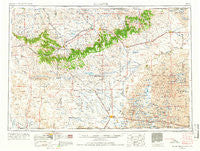
Alliance, Nebraska, USGS topographic map dated 1955.
Includes geographic coordinates (latitude and longitude). This topographic map is suitable for hiking, camping, and exploring, or framing it as a wall map.
Printed on-demand using high resolution imagery, on heavy weight and acid free paper, or alternatively on a variety of synthetic materials.
Topos available on paper, Waterproof, Poly, or Tyvek. Usually shipping rolled, unless combined with other folded maps in one order.
- Product Number: USGS-5564024
- Free digital map download (high-resolution, GeoPDF): Alliance, Nebraska (file size: 20 MB)
- Map Size: please refer to the dimensions of the GeoPDF map above
- Weight (paper map): ca. 55 grams
- Map Type: POD USGS Topographic Map
- Map Series: HTMC
- Map Verison: Historical
- Cell ID: 68642
- Scan ID: 317907
- Imprint Year: 1966
- Woodland Tint: Yes
- Edit Year: 1965
- Field Check Year: 1955
- Datum: Unstated
- Map Projection: Transverse Mercator
- Map published by United States Geological Survey
- Map published by United States Army Corps of Engineers
- Map published by United States Army
- Map Language: English
- Scanner Resolution: 600 dpi
- Map Cell Name: Alliance
- Grid size: 1 X 2 Degree
- Date on map: 1955
- Map Scale: 1:250000
- Geographical region: Nebraska, United States
Neighboring Maps:
All neighboring USGS topo maps are available for sale online at a variety of scales.
Spatial coverage:
Topo map Alliance, Nebraska, covers the geographical area associated the following places:
- Chadron - Belmont - Pine Ridge - Letan - J and L Trailer Court - Roach - Antioch - Alliance - Wagon Wheel Trailer Court - Prairie Pines Retirement Community - Agate - Nonpareil - Westview Mobile Park - Albany (historical) - Horn - Kellers Trailer Court - Andrews - Adaton (historical) - Scoville - Meadows Trailer Court - Peters (historical) - Spurior Place - Glen - Pine Ridge - Story - Hay Springs - Bingham - Joder - Redwood Mobile Court - Marsland - Orella - Berea - Grayson (historical) - Whiteclay - Hemingford - Rushville - Marple (historical) - Otis Motel and Trailer Court - Lulu (historical) - Lakeside - Clinton - Shedeeds Trailer Court - Whitney - Dakota Junction - Hoffland - Gordon - Tower Plaza Mobile Home Park - Montrose - Jennings (historical) - Trailerville Court - Five Points - Bordeaux - Crawford - Harrison - Hilton (historical) - Ellsworth - Clark Trailer Court
- Map Area ID: AREA4342-104-102
- Northwest corner Lat/Long code: USGSNW43-104
- Northeast corner Lat/Long code: USGSNE43-102
- Southwest corner Lat/Long code: USGSSW42-104
- Southeast corner Lat/Long code: USGSSE42-102
- Northern map edge Latitude: 43
- Southern map edge Latitude: 42
- Western map edge Longitude: -104
- Eastern map edge Longitude: -102


