
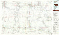
~ Red Cloud NE topo map, 1:100000 scale, 30 X 60 Minute, Historical, 1985, updated 1985
Red Cloud, Nebraska, USGS topographic map dated 1985.
Includes geographic coordinates (latitude and longitude). This topographic map is suitable for hiking, camping, and exploring, or framing it as a wall map.
Printed on-demand using high resolution imagery, on heavy weight and acid free paper, or alternatively on a variety of synthetic materials.
Topos available on paper, Waterproof, Poly, or Tyvek. Usually shipping rolled, unless combined with other folded maps in one order.
- Product Number: USGS-5563756
- Free digital map download (high-resolution, GeoPDF): Red Cloud, Nebraska (file size: 18 MB)
- Map Size: please refer to the dimensions of the GeoPDF map above
- Weight (paper map): ca. 55 grams
- Map Type: POD USGS Topographic Map
- Map Series: HTMC
- Map Verison: Historical
- Cell ID: 72652
- Scan ID: 317762
- Imprint Year: 1985
- Woodland Tint: Yes
- Aerial Photo Year: 1981
- Edit Year: 1985
- Datum: NAD27
- Map Projection: Universal Transverse Mercator
- Planimetric: Yes
- Map published by United States Geological Survey
- Map Language: English
- Scanner Resolution: 600 dpi
- Map Cell Name: Red Cloud
- Grid size: 30 X 60 Minute
- Date on map: 1985
- Map Scale: 1:100000
- Geographical region: Nebraska, United States
Neighboring Maps:
All neighboring USGS topo maps are available for sale online at a variety of scales.
Spatial coverage:
Topo map Red Cloud, Nebraska, covers the geographical area associated the following places:
- Guide Rock - Abdal (historical) - Red Cloud - Pawnee Village - Amboy - Ayr - Holstein - Cowles - Campbell - Bostwick - Cadams - Spring Ranch (historical) - Blue Hill - Deweese - Brickton (historical) - Nelson - Smyrna - Rosemont - Upland - Pauline - Macon - Mount Clare - Inavale - Riverton - Lawrence - Ayr Junction - Bladen - South Side Mobile Home Court - Anan - Countryside Mobile Home Park - Minden - Superior - Norman - Lester Junction - Saint Stephens - Fairfield - Roseland - Franklin
- Map Area ID: AREA40.540-99-98
- Northwest corner Lat/Long code: USGSNW40.5-99
- Northeast corner Lat/Long code: USGSNE40.5-98
- Southwest corner Lat/Long code: USGSSW40-99
- Southeast corner Lat/Long code: USGSSE40-98
- Northern map edge Latitude: 40.5
- Southern map edge Latitude: 40
- Western map edge Longitude: -99
- Eastern map edge Longitude: -98


