
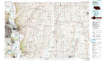
~ Omaha NE topo map, 1:100000 scale, 30 X 60 Minute, Historical, 1985, updated 1993
Omaha, Nebraska, USGS topographic map dated 1985.
Includes geographic coordinates (latitude and longitude). This topographic map is suitable for hiking, camping, and exploring, or framing it as a wall map.
Printed on-demand using high resolution imagery, on heavy weight and acid free paper, or alternatively on a variety of synthetic materials.
Topos available on paper, Waterproof, Poly, or Tyvek. Usually shipping rolled, unless combined with other folded maps in one order.
- Product Number: USGS-5563746
- Free digital map download (high-resolution, GeoPDF): Omaha, Nebraska (file size: 33 MB)
- Map Size: please refer to the dimensions of the GeoPDF map above
- Weight (paper map): ca. 55 grams
- Map Type: POD USGS Topographic Map
- Map Series: HTMC
- Map Verison: Historical
- Cell ID: 68090
- Scan ID: 317757
- Imprint Year: 1993
- Woodland Tint: Yes
- Photo Inspection Year: 1990
- Aerial Photo Year: 1982
- Edit Year: 1985
- Datum: NAD27
- Map Projection: Universal Transverse Mercator
- Map published by United States Geological Survey
- Map Language: English
- Scanner Resolution: 600 dpi
- Map Cell Name: Omaha
- Grid size: 30 X 60 Minute
- Date on map: 1985
- Map Scale: 1:100000
- Geographical region: Nebraska, United States
Neighboring Maps:
All neighboring USGS topo maps are available for sale online at a variety of scales.
Spatial coverage:
Topo map Omaha, Nebraska, covers the geographical area associated the following places:
- Home Park - South Omaha - Marne - Grable - La Platte - Garden Valley Courts - Emerson - Accent Mobile Home Parks - Oreapolis - Hawthorne - McClelland - Taylor - Elliott - Honey Creek - York Center - Hentons (historical) - Indiantown (historical) - Walnut - Fort Crook - Silver City - Capehart - Green Acres Mobile Home Park - Regency of Iowa Mobile Home Park - Treynor - Red Oak - Oakland - Mineola - Minden - Lewis - Henderson - Malvern - Pigeon - Beechwood - Neola - Plattsmouth - Pacific City - Quick - Carter Lake - HiVue Mobile Home Park - Avoca - Gilliatt - Carson - Hill City Mobile Home Park - Loveland - Golden Spike Mobile Home Park - Country Estates Mobile Home Park - Newtown (historical) - Kemling (historical) - Griswold - Gilmore - Underwood - Macedonia - Wales - Wooded Lake Mobile Home Park - Nashville - Council Bluffs - Bellevue - Mills - Washington Mobile Home Terrace - Hillsdale - Gilmore Junction - Sands Trailer Park - Peter - Avery - Bluff Acres Mobile Home Park - Martinview Mobile Home Park - Atlantic - Town and Country Mobile Homes - Chautauqua - Hastings - Crescent - Villa Village Mobile Home Park - Iola (historical) - Wallin - Rumsey - Frankfort (historical) - Paradise Park - Stennett - Folsom - Hancock - Harlan Junction (historical) - Clara - Omaha - Glenwood - East Omaha - Weston - McPherson - Overland Mobile Home Park - Ponderosa Village Mobile Home Park - Bentley - Biddick (historical) - Dumfries - Pacific Junction - Ascot - Balfour
- Map Area ID: AREA41.541-96-95
- Northwest corner Lat/Long code: USGSNW41.5-96
- Northeast corner Lat/Long code: USGSNE41.5-95
- Southwest corner Lat/Long code: USGSSW41-96
- Southeast corner Lat/Long code: USGSSE41-95
- Northern map edge Latitude: 41.5
- Southern map edge Latitude: 41
- Western map edge Longitude: -96
- Eastern map edge Longitude: -95


