
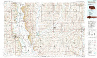
~ Nebraska City NE topo map, 1:100000 scale, 30 X 60 Minute, Historical, 1993, updated 1993
Nebraska City, Nebraska, USGS topographic map dated 1993.
Includes geographic coordinates (latitude and longitude). This topographic map is suitable for hiking, camping, and exploring, or framing it as a wall map.
Printed on-demand using high resolution imagery, on heavy weight and acid free paper, or alternatively on a variety of synthetic materials.
Topos available on paper, Waterproof, Poly, or Tyvek. Usually shipping rolled, unless combined with other folded maps in one order.
- Product Number: USGS-5563732
- Free digital map download (high-resolution, GeoPDF): Nebraska City, Nebraska (file size: 30 MB)
- Map Size: please refer to the dimensions of the GeoPDF map above
- Weight (paper map): ca. 55 grams
- Map Type: POD USGS Topographic Map
- Map Series: HTMC
- Map Verison: Historical
- Cell ID: 68033
- Scan ID: 317750
- Imprint Year: 1993
- Woodland Tint: Yes
- Aerial Photo Year: 1990
- Edit Year: 1993
- Datum: NAD27
- Map Projection: Universal Transverse Mercator
- Map published by United States Geological Survey
- Map Language: English
- Scanner Resolution: 600 dpi
- Map Cell Name: Nebraska City
- Grid size: 30 X 60 Minute
- Date on map: 1993
- Map Scale: 1:100000
- Geographical region: Nebraska, United States
Neighboring Maps:
All neighboring USGS topo maps are available for sale online at a variety of scales.
Spatial coverage:
Topo map Nebraska City, Nebraska, covers the geographical area associated the following places:
- Essex - Yorktown - Elmo - Farmers City - Bartlett - Mynard - Coin - Tarkio City (historical) - Shambaugh - Northboro - Percival - Union - Elberon - Anderson - Nyman - McPaul - South Blanchard (historical) - Page Center - Nehawka - Randolph - Willsburg (historical) - Imogene - Park EZ Mobile Home Court - Coburg - Blanchard - Wyoming - High Creek - Strahan - Tabor - Kanosha (historical) - Minersville - Hepburn - Shenandoah - Eureka - East Port (historical) - Todd - Julian - Murray - Braddyville - Stanton - Payne - Applewood Mobile Home Park - Climax - Paul - White Cloud - South Side Mobile Home Park - Hamburg - Clarinda Junction (historical) - Summit - College Springs - Clark - Sidney - Norwich - Riverton - Rock Bluff (historical) - Bethesda - Thurman - Solomon - Clarinda - Nebraska City - Farragut - Roberts Mobile Home Court - Clearmont - Burr Oak - Bingham - Westboro
- Map Area ID: AREA4140.5-96-95
- Northwest corner Lat/Long code: USGSNW41-96
- Northeast corner Lat/Long code: USGSNE41-95
- Southwest corner Lat/Long code: USGSSW40.5-96
- Southeast corner Lat/Long code: USGSSE40.5-95
- Northern map edge Latitude: 41
- Southern map edge Latitude: 40.5
- Western map edge Longitude: -96
- Eastern map edge Longitude: -95


