
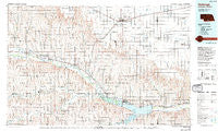
~ Holdrege NE topo map, 1:100000 scale, 30 X 60 Minute, Historical, 1986, updated 1994
Holdrege, Nebraska, USGS topographic map dated 1986.
Includes geographic coordinates (latitude and longitude). This topographic map is suitable for hiking, camping, and exploring, or framing it as a wall map.
Printed on-demand using high resolution imagery, on heavy weight and acid free paper, or alternatively on a variety of synthetic materials.
Topos available on paper, Waterproof, Poly, or Tyvek. Usually shipping rolled, unless combined with other folded maps in one order.
- Product Number: USGS-5563708
- Free digital map download (high-resolution, GeoPDF): Holdrege, Nebraska (file size: 28 MB)
- Map Size: please refer to the dimensions of the GeoPDF map above
- Weight (paper map): ca. 55 grams
- Map Type: POD USGS Topographic Map
- Map Series: HTMC
- Map Verison: Historical
- Cell ID: 72641
- Scan ID: 317738
- Imprint Year: 1994
- Woodland Tint: Yes
- Photo Inspection Year: 1990
- Aerial Photo Year: 1981
- Edit Year: 1986
- Datum: NAD27
- Map Projection: Universal Transverse Mercator
- Map published by United States Geological Survey
- Map Language: English
- Scanner Resolution: 600 dpi
- Map Cell Name: Holdrege
- Grid size: 30 X 60 Minute
- Date on map: 1986
- Map Scale: 1:100000
- Geographical region: Nebraska, United States
Neighboring Maps:
All neighboring USGS topo maps are available for sale online at a variety of scales.
Spatial coverage:
Topo map Holdrege, Nebraska, covers the geographical area associated the following places:
- Dewaynes Trailer Court - Precept - Atlanta - Mascot - Axtell - Republican City - Bloomington - Sacramento - Oxford Junction - Clyde - Hildreth - Westside Plaza Mobile Home Park - Holdrege - Beaver City - Ragan - Funk - Wilcox - Stamford - Edison - Arapahoe - Oxford - Loomis - Naponee - Huntley - Alma - Hendley - Keene - Taylor Manor Trailer Court - Orleans - Flynn Junction - Deerfield Corner - Hollinger
- Map Area ID: AREA40.540-100-99
- Northwest corner Lat/Long code: USGSNW40.5-100
- Northeast corner Lat/Long code: USGSNE40.5-99
- Southwest corner Lat/Long code: USGSSW40-100
- Southeast corner Lat/Long code: USGSSE40-99
- Northern map edge Latitude: 40.5
- Southern map edge Latitude: 40
- Western map edge Longitude: -100
- Eastern map edge Longitude: -99


