
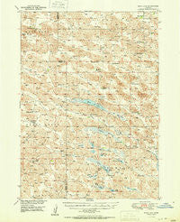
~ Moon Lake NE topo map, 1:62500 scale, 15 X 15 Minute, Historical, 1951
Moon Lake, Nebraska, USGS topographic map dated 1951.
Includes geographic coordinates (latitude and longitude). This topographic map is suitable for hiking, camping, and exploring, or framing it as a wall map.
Printed on-demand using high resolution imagery, on heavy weight and acid free paper, or alternatively on a variety of synthetic materials.
Topos available on paper, Waterproof, Poly, or Tyvek. Usually shipping rolled, unless combined with other folded maps in one order.
- Product Number: USGS-5563490
- Free digital map download (high-resolution, GeoPDF): Moon Lake, Nebraska (file size: 10 MB)
- Map Size: please refer to the dimensions of the GeoPDF map above
- Weight (paper map): ca. 55 grams
- Map Type: POD USGS Topographic Map
- Map Series: HTMC
- Map Verison: Historical
- Cell ID: 57844
- Scan ID: 317615
- Woodland Tint: Yes
- Aerial Photo Year: 1946
- Field Check Year: 1949
- Datum: NAD27
- Map Projection: Polyconic
- Map published by United States Geological Survey
- Map Language: English
- Scanner Resolution: 600 dpi
- Map Cell Name: Moon Lake
- Grid size: 15 X 15 Minute
- Date on map: 1951
- Map Scale: 1:62500
- Geographical region: Nebraska, United States
Neighboring Maps:
All neighboring USGS topo maps are available for sale online at a variety of scales.
Spatial coverage:
Topo map Moon Lake, Nebraska, covers the geographical area associated the following places:
- School Number 13 - Tracy Ranch - Morris Ranch - Rush Lake - American Game Marsh State Wildlife Management Area - Moonlake Public School - Long Lake State Wildlife Management Area - Long Lake Recreation Grounds - Allen Ranch - Crystal Lake - School Number 6 - Moon Lake Marsh - Robinson Lake - Galusha Ranch - Wrage Ranch - Long Lake - School Number 112 - Johnstown Election Precinct - School Number 41 - Harr Valley - Enders Lake Post Office (historical) - Hershiser Ranch - South Wrage School - Lake Ranch - Clapper Marsh - W Gudgel Ranch - White Cap Hill - McDaniel Ranch - Moon Lake - A Gudgel Ranch - O'Hara Ranch - South Twin Lake State Wildlife Management Area - Baldwin Camp - School Number 44 - Enders Marsh - Johnson Ranch - South Twin Lake - Philbrick Lake - North Twin Lake - North Wrage School - South Fork Calamus River - Skull Lake - Enders Lake - Rat Lake - Enders School - Clapper Lake - Remalia Valley - Oatman Ranch - Clear Lake - Enders Ranch - Alkali Lake - John Ranch
- Map Area ID: AREA42.542.25-100.25-100
- Northwest corner Lat/Long code: USGSNW42.5-100.25
- Northeast corner Lat/Long code: USGSNE42.5-100
- Southwest corner Lat/Long code: USGSSW42.25-100.25
- Southeast corner Lat/Long code: USGSSE42.25-100
- Northern map edge Latitude: 42.5
- Southern map edge Latitude: 42.25
- Western map edge Longitude: -100.25
- Eastern map edge Longitude: -100


