
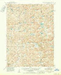
~ Longfellow Lake NE topo map, 1:62500 scale, 15 X 15 Minute, Historical, 1950
Longfellow Lake, Nebraska, USGS topographic map dated 1950.
Includes geographic coordinates (latitude and longitude). This topographic map is suitable for hiking, camping, and exploring, or framing it as a wall map.
Printed on-demand using high resolution imagery, on heavy weight and acid free paper, or alternatively on a variety of synthetic materials.
Topos available on paper, Waterproof, Poly, or Tyvek. Usually shipping rolled, unless combined with other folded maps in one order.
- Product Number: USGS-5563470
- Free digital map download (high-resolution, GeoPDF): Longfellow Lake, Nebraska (file size: 10 MB)
- Map Size: please refer to the dimensions of the GeoPDF map above
- Weight (paper map): ca. 55 grams
- Map Type: POD USGS Topographic Map
- Map Series: HTMC
- Map Verison: Historical
- Cell ID: 56882
- Scan ID: 317603
- Woodland Tint: Yes
- Visual Version Number: 1
- Aerial Photo Year: 1946
- Field Check Year: 1948
- Datum: NAD27
- Map Projection: Polyconic
- Map published by United States Geological Survey
- Map Language: English
- Scanner Resolution: 600 dpi
- Map Cell Name: Longfellow Lake
- Grid size: 15 X 15 Minute
- Date on map: 1950
- Map Scale: 1:62500
- Geographical region: Nebraska, United States
Neighboring Maps:
All neighboring USGS topo maps are available for sale online at a variety of scales.
Spatial coverage:
Topo map Longfellow Lake, Nebraska, covers the geographical area associated the following places:
- School Number 18 - Kramer Valley - Vincent Valley - Lost Bull Valley - Curry Lake - East Finn Valley - Jones Valley - Galdon Lake - Young Valley - Mar Lake - School Number 71 - Kirkpatrick Valley - Round Valley - Dipping Vat Lake - Farm Valley - Open Box Arrow Ranch - Ballinger Valley - Wild Horse Flats - Sophia Valley - School Number 9 - French Valley - Anderson Valley - Bandy Valley - Lower Elk Valley - Daley Valley - North Valley - Scheffenburg Valley - Alkali Lake - Hog Valley - Dominick Lake - Elk Lake - School Number 22 - Schmoker Valley - Cary Valley - Lotspeich Valley - School Number 32 - Devasier Valley - Upper Elk Valley - Diamond Valley - R Kincaid Lake - Leech Valley - Double Supply Valley - West Finn Valley - Clark Lake - Robb Valley - Black Steer Valley - Potter Lake - McCarty Lake - Warneke Valley - H Lotspeich Lake - Feesterman Valley - E Kincaid Lake - Farm Valley Ranch - Windmill Valley - Groves Lake - Jack Lake - Julian Valley - Tree Claim Valley - Round Valley - Sutton N-Arrow Ranch - Jerry Lake - Rackett 4 Volunteer Fire Department - Keenan Valley - Barber Valley - Britton Lake - Longfellow Lake
- Map Area ID: AREA4241.75-102.25-102
- Northwest corner Lat/Long code: USGSNW42-102.25
- Northeast corner Lat/Long code: USGSNE42-102
- Southwest corner Lat/Long code: USGSSW41.75-102.25
- Southeast corner Lat/Long code: USGSSE41.75-102
- Northern map edge Latitude: 42
- Southern map edge Latitude: 41.75
- Western map edge Longitude: -102.25
- Eastern map edge Longitude: -102


