
~ George Lake NE topo map, 1:62500 scale, 15 X 15 Minute, Historical, 1948, updated 1976
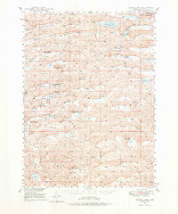
George Lake, Nebraska, USGS topographic map dated 1948.
Includes geographic coordinates (latitude and longitude). This topographic map is suitable for hiking, camping, and exploring, or framing it as a wall map.
Printed on-demand using high resolution imagery, on heavy weight and acid free paper, or alternatively on a variety of synthetic materials.
Topos available on paper, Waterproof, Poly, or Tyvek. Usually shipping rolled, unless combined with other folded maps in one order.
- Product Number: USGS-5563403
- Free digital map download (high-resolution, GeoPDF): George Lake, Nebraska (file size: 10 MB)
- Map Size: please refer to the dimensions of the GeoPDF map above
- Weight (paper map): ca. 55 grams
- Map Type: POD USGS Topographic Map
- Map Series: HTMC
- Map Verison: Historical
- Cell ID: 54543
- Scan ID: 317571
- Imprint Year: 1976
- Aerial Photo Year: 1946
- Field Check Year: 1948
- Datum: NAD27
- Map Projection: Polyconic
- Map published by United States Geological Survey
- Map Language: English
- Scanner Resolution: 600 dpi
- Map Cell Name: George Lake
- Grid size: 15 X 15 Minute
- Date on map: 1948
- Map Scale: 1:62500
- Geographical region: Nebraska, United States
Neighboring Maps:
All neighboring USGS topo maps are available for sale online at a variety of scales.
Spatial coverage:
Topo map George Lake, Nebraska, covers the geographical area associated the following places:
- Whaley Valley - Boots Ranch - Minor Ranch - Merrihew Ranch - Van Nortwick Valley - Little Swede Valley - Big Swede Valley - Merry Airport (historical) - Alkali Lake - Big Buckboard Lake - Lowes Camp - Swede Lake - George Lake - Gross Valley - Burgess Ranch - Rudolph Dubs Ranch - Juten Valley - Little Buckboard Lake - Lowe Ranch - Cricket Lake - Arthur Dubs Ranch - Merrihew Airport - Wild Horse Hill - Ashby Election Precinct - Paul Sweet Ranch - Locust School - Sid Sweet Ranch - Hawthorne Lake - Long Valley - Burgess Ranch - Farm Valley School - Pleasant Valley - Sears Lake - Willey Ranch - Hyannis High School - Lowe Ranch - Hyannis Elementary School - Minor-Adams Ranch - Anderson Valley - Bob Merrihew Ranch
- Map Area ID: AREA4241.75-102-101.75
- Northwest corner Lat/Long code: USGSNW42-102
- Northeast corner Lat/Long code: USGSNE42-101.75
- Southwest corner Lat/Long code: USGSSW41.75-102
- Southeast corner Lat/Long code: USGSSE41.75-101.75
- Northern map edge Latitude: 42
- Southern map edge Latitude: 41.75
- Western map edge Longitude: -102
- Eastern map edge Longitude: -101.75


