
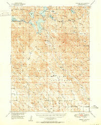
~ Crescent Lake NE topo map, 1:62500 scale, 15 X 15 Minute, Historical, 1950
Crescent Lake, Nebraska, USGS topographic map dated 1950.
Includes geographic coordinates (latitude and longitude). This topographic map is suitable for hiking, camping, and exploring, or framing it as a wall map.
Printed on-demand using high resolution imagery, on heavy weight and acid free paper, or alternatively on a variety of synthetic materials.
Topos available on paper, Waterproof, Poly, or Tyvek. Usually shipping rolled, unless combined with other folded maps in one order.
- Product Number: USGS-5563373
- Free digital map download (high-resolution, GeoPDF): Crescent Lake, Nebraska (file size: 10 MB)
- Map Size: please refer to the dimensions of the GeoPDF map above
- Weight (paper map): ca. 55 grams
- Map Type: POD USGS Topographic Map
- Map Series: HTMC
- Map Verison: Historical
- Cell ID: 53076
- Scan ID: 317553
- Woodland Tint: Yes
- Aerial Photo Year: 1946
- Field Check Year: 1949
- Datum: NAD27
- Map Projection: Polyconic
- Map published by United States Geological Survey
- Map Language: English
- Scanner Resolution: 600 dpi
- Map Cell Name: Crescent Lake
- Grid size: 15 X 15 Minute
- Date on map: 1950
- Map Scale: 1:62500
- Geographical region: Nebraska, United States
Neighboring Maps:
All neighboring USGS topo maps are available for sale online at a variety of scales.
Spatial coverage:
Topo map Crescent Lake, Nebraska, covers the geographical area associated the following places:
- Mallard Arm - Meeker Valley - Antelope Valley School - Evergreen Church - Blue Creek Ditch - Lower Jones Valley - Camp Valley - Crescent Lake National Wildlife Refuge - Red Kate Valley - Sugar Loaf Hill - Richstein Ranch - Deer Lake - Island Lake - Crescent Lake - Jones Lake - Campbell Valley - Christ Lake - Cross Lake - Blue Lake - Kingery Cemetery - Campbell Lake - Swede Valley - Crescent Lake Dam - Eldred Camp - Old Lady Beam Hill - Swan Lake - Dogtown Flats - Camp Lake - Hutchinson School - Antelope Valley - Crane Lake - Hackberry Lake - Garden County - Lost Creek Election Precinct - Crescent Lake - Jones Run - Little Hackberry Lake - Swede Lake - Lone Star School
- Map Area ID: AREA41.7541.5-102.5-102.25
- Northwest corner Lat/Long code: USGSNW41.75-102.5
- Northeast corner Lat/Long code: USGSNE41.75-102.25
- Southwest corner Lat/Long code: USGSSW41.5-102.5
- Southeast corner Lat/Long code: USGSSE41.5-102.25
- Northern map edge Latitude: 41.75
- Southern map edge Latitude: 41.5
- Western map edge Longitude: -102.5
- Eastern map edge Longitude: -102.25


