
~ Cody Lake NE topo map, 1:62500 scale, 15 X 15 Minute, Historical, 1949, updated 1972
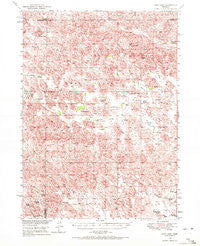
Cody Lake, Nebraska, USGS topographic map dated 1949.
Includes geographic coordinates (latitude and longitude). This topographic map is suitable for hiking, camping, and exploring, or framing it as a wall map.
Printed on-demand using high resolution imagery, on heavy weight and acid free paper, or alternatively on a variety of synthetic materials.
Topos available on paper, Waterproof, Poly, or Tyvek. Usually shipping rolled, unless combined with other folded maps in one order.
- Product Number: USGS-5563367
- Free digital map download (high-resolution, GeoPDF): Cody Lake, Nebraska (file size: 11 MB)
- Map Size: please refer to the dimensions of the GeoPDF map above
- Weight (paper map): ca. 55 grams
- Map Type: POD USGS Topographic Map
- Map Series: HTMC
- Map Verison: Historical
- Cell ID: 52738
- Scan ID: 317551
- Imprint Year: 1972
- Woodland Tint: Yes
- Aerial Photo Year: 1946
- Field Check Year: 1949
- Datum: NAD27
- Map Projection: Polyconic
- Map published by United States Geological Survey
- Map Language: English
- Scanner Resolution: 600 dpi
- Map Cell Name: Cody Lake
- Grid size: 15 X 15 Minute
- Date on map: 1949
- Map Scale: 1:62500
- Geographical region: Nebraska, United States
Neighboring Maps:
All neighboring USGS topo maps are available for sale online at a variety of scales.
Spatial coverage:
Topo map Cody Lake, Nebraska, covers the geographical area associated the following places:
- Happy Hollow School - L Barnum Ranch - Johnson Ranch - Oliver Ranch - Brosius Ranch - C Uphoff Ranch - Grate Ranch - Sturtz Ranch - Kramer Ranch - Viehmeyer Ranch - Lone Valley School - Chapman Ranch - Cottonwood Grove School - Trumbull Ranch - Lingner Ranch - Santos Ranch - Brush Lake - Birth Ranch - C Munson Ranch - Star Ranch - Cody Lake - Happy Hollow - Lutes Ranch - Beacon Brothers Ranch - Cody Lake School - Prairie Dell School - Green Valley - Pfeiffer Ranch - Christian Ranch - Lone Valley - Stapleton Number 1 Election Precinct - Jividen Ranch - Kramer Ranch - Lair Ranch
- Map Area ID: AREA41.7541.5-100.75-100.5
- Northwest corner Lat/Long code: USGSNW41.75-100.75
- Northeast corner Lat/Long code: USGSNE41.75-100.5
- Southwest corner Lat/Long code: USGSSW41.5-100.75
- Southeast corner Lat/Long code: USGSSE41.5-100.5
- Northern map edge Latitude: 41.75
- Southern map edge Latitude: 41.5
- Western map edge Longitude: -100.75
- Eastern map edge Longitude: -100.5


