
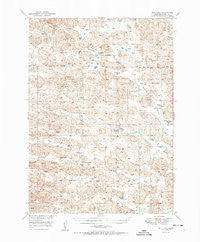
~ Bull Lake NE topo map, 1:62500 scale, 15 X 15 Minute, Historical, 1951
Bull Lake, Nebraska, USGS topographic map dated 1951.
Includes geographic coordinates (latitude and longitude). This topographic map is suitable for hiking, camping, and exploring, or framing it as a wall map.
Printed on-demand using high resolution imagery, on heavy weight and acid free paper, or alternatively on a variety of synthetic materials.
Topos available on paper, Waterproof, Poly, or Tyvek. Usually shipping rolled, unless combined with other folded maps in one order.
- Product Number: USGS-5563359
- Free digital map download (high-resolution, GeoPDF): Bull Lake, Nebraska (file size: 10 MB)
- Map Size: please refer to the dimensions of the GeoPDF map above
- Weight (paper map): ca. 55 grams
- Map Type: POD USGS Topographic Map
- Map Series: HTMC
- Map Verison: Historical
- Cell ID: 51913
- Scan ID: 317546
- Woodland Tint: Yes
- Visual Version Number: 1
- Aerial Photo Year: 1946
- Field Check Year: 1949
- Datum: NAD27
- Map Projection: Polyconic
- Map published by United States Geological Survey
- Map Language: English
- Scanner Resolution: 600 dpi
- Map Cell Name: Bull Lake
- Grid size: 15 X 15 Minute
- Date on map: 1951
- Map Scale: 1:62500
- Geographical region: Nebraska, United States
Neighboring Maps:
All neighboring USGS topo maps are available for sale online at a variety of scales.
Spatial coverage:
Topo map Bull Lake, Nebraska, covers the geographical area associated the following places:
- Kidder Ranch - Alkali Pond - S Hanna Ranch - Roth Ranch - Simonson Ranch - Robinson Lake - McCloud Ranch - Murphy Swamp - Sears Ranch - Boyer Ranch - School Number 113 - Twin Lakes - A Andrews Ranch - Woodsons Windmill - Allen Valley - Stub Lake - Square Lake - Andrews School - Mud Lake - Wells School - Humpert Lake - McLeod Ranch - Anders Ranch - Andrews Ranch - Murphy Ranch - Stout Lake - Packingham Lake - B Hanna Ranch - Bull Lake - Horse Creek - Sears School - Hatters Bridge - Big Creek - Lowes Lake
- Map Area ID: AREA42.542.25-101-100.75
- Northwest corner Lat/Long code: USGSNW42.5-101
- Northeast corner Lat/Long code: USGSNE42.5-100.75
- Southwest corner Lat/Long code: USGSSW42.25-101
- Southeast corner Lat/Long code: USGSSE42.25-100.75
- Northern map edge Latitude: 42.5
- Southern map edge Latitude: 42.25
- Western map edge Longitude: -101
- Eastern map edge Longitude: -100.75


