
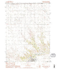
~ Valentine North NE topo map, 1:24000 scale, 7.5 X 7.5 Minute, Historical, 1983, updated 1984
Valentine North, Nebraska, USGS topographic map dated 1983.
Includes geographic coordinates (latitude and longitude). This topographic map is suitable for hiking, camping, and exploring, or framing it as a wall map.
Printed on-demand using high resolution imagery, on heavy weight and acid free paper, or alternatively on a variety of synthetic materials.
Topos available on paper, Waterproof, Poly, or Tyvek. Usually shipping rolled, unless combined with other folded maps in one order.
- Product Number: USGS-5563041
- Free digital map download (high-resolution, GeoPDF): Valentine North, Nebraska (file size: 10 MB)
- Map Size: please refer to the dimensions of the GeoPDF map above
- Weight (paper map): ca. 55 grams
- Map Type: POD USGS Topographic Map
- Map Series: HTMC
- Map Verison: Historical
- Cell ID: 46530
- Scan ID: 317381
- Imprint Year: 1984
- Woodland Tint: Yes
- Visual Version Number: 1
- Aerial Photo Year: 1977
- Edit Year: 1983
- Field Check Year: 1980
- Datum: NAD27
- Map Projection: Lambert Conformal Conic
- Provisional map: Yes
- Map published by United States Geological Survey
- Map Language: English
- Scanner Resolution: 600 dpi
- Map Cell Name: Valentine North
- Grid size: 7.5 X 7.5 Minute
- Date on map: 1983
- Map Scale: 1:24000
- Geographical region: Nebraska, United States
Neighboring Maps:
All neighboring USGS topo maps are available for sale online at a variety of scales.
Spatial coverage:
Topo map Valentine North, Nebraska, covers the geographical area associated the following places:
- Presbyterian Church - Seventh Day Adventist Church - Government Canyon - Valentine Vision Center - Ward School - School Number 12 - Valentine Elementary School - Sandhills Museum - Valentine Rural High School - Cherry County Court House - Valentine State Fish Hatchery - Berean Fundamental Church - Spring Creek - Ecological Park - Assembly of God Church - Saint Johns Episcopal Church - Frederick Peak - Decker School - Richland Harmony Cemetery - Cherry County Physicians Clinic - Mid - Cherry Rural Fire District - Valentine Public Library - Pine View Clinic - Saint Nicholas Church - School Number 121 - Cherry County Sheriff's Office - Mill Pond - Valentine City Park Campground - McCormick Eye Clinic - United Methodist Church - Pierce Milling Plant Reservoir - Fish Hatchery Lake - Pine View Good Samaritan Center - The Church of Jesus Christ of Latter Day Saints - Valentine City Park - Valentine City Park Dam - Pierce Milling Plant Dam - Fishberry Creek - Valentine Reservoir - New Harmony School - Cherry County Hospital - Valentine Police Department
- Map Area ID: AREA4342.875-100.625-100.5
- Northwest corner Lat/Long code: USGSNW43-100.625
- Northeast corner Lat/Long code: USGSNE43-100.5
- Southwest corner Lat/Long code: USGSSW42.875-100.625
- Southeast corner Lat/Long code: USGSSE42.875-100.5
- Northern map edge Latitude: 43
- Southern map edge Latitude: 42.875
- Western map edge Longitude: -100.625
- Eastern map edge Longitude: -100.5


