
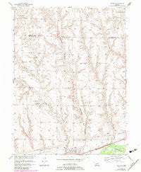
~ Bartley NE topo map, 1:24000 scale, 7.5 X 7.5 Minute, Historical, 1956, updated 1983
Bartley, Nebraska, USGS topographic map dated 1956.
Includes geographic coordinates (latitude and longitude). This topographic map is suitable for hiking, camping, and exploring, or framing it as a wall map.
Printed on-demand using high resolution imagery, on heavy weight and acid free paper, or alternatively on a variety of synthetic materials.
Topos available on paper, Waterproof, Poly, or Tyvek. Usually shipping rolled, unless combined with other folded maps in one order.
- Product Number: USGS-5559817
- Free digital map download (high-resolution, GeoPDF): Bartley, Nebraska (file size: 12 MB)
- Map Size: please refer to the dimensions of the GeoPDF map above
- Weight (paper map): ca. 55 grams
- Map Type: POD USGS Topographic Map
- Map Series: HTMC
- Map Verison: Historical
- Cell ID: 2530
- Scan ID: 315767
- Imprint Year: 1983
- Woodland Tint: Yes
- Photo Revision Year: 1983
- Aerial Photo Year: 1981
- Edit Year: 1983
- Field Check Year: 1956
- Survey Year: 1939
- Datum: NAD27
- Map Projection: Polyconic
- Map published by United States Geological Survey
- Map Language: English
- Scanner Resolution: 600 dpi
- Map Cell Name: Bartley
- Grid size: 7.5 X 7.5 Minute
- Date on map: 1956
- Map Scale: 1:24000
- Geographical region: Nebraska, United States
Neighboring Maps:
All neighboring USGS topo maps are available for sale online at a variety of scales.
Spatial coverage:
Topo map Bartley, Nebraska, covers the geographical area associated the following places:
- Dry Creek Dam 8-A - Dry Creek Dam 8-C - Kemper Memorial United Methodist Church - Walnut Grove School - Dry Creek Cemetery - Bartley Christian Church - Dry Creek School - Mount Zion Church - Bartley Public Library - Dry Creek Reservoir 8-B - Bartley Cemetery - Dry Creek Dam 8-C - Dry Creek Reservoir 8-A - United Brethren Church - Wildcat Creek - Township of Alliance - Alliance School - Dry Creek Dam 5-A - Mallalieu College (historical) - Mallalieu University Historical Marker - Bartley Equity Elevator - Fair Hope School - Alliance Election Precinct - Pleasant Hill School - Village of Bartley - Dry Creek Dam 3-A - Bartley Post Office - North Valley Election Precinct - Dry Creek Reservoir 3-A - Mount Zion Cemetery - Twin Valley High School - Dry Creek Dam 8-B - Dry Creek Reservoir 5-A - Sunnyside School (historical) - Bartley Fire Department
- Map Area ID: AREA40.37540.25-100.375-100.25
- Northwest corner Lat/Long code: USGSNW40.375-100.375
- Northeast corner Lat/Long code: USGSNE40.375-100.25
- Southwest corner Lat/Long code: USGSSW40.25-100.375
- Southeast corner Lat/Long code: USGSSE40.25-100.25
- Northern map edge Latitude: 40.375
- Southern map edge Latitude: 40.25
- Western map edge Longitude: -100.375
- Eastern map edge Longitude: -100.25


