
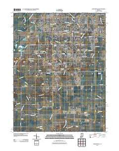
~ Bargersville IN topo map, 1:24000 scale, 7.5 X 7.5 Minute, Historical, 2011
Bargersville, Indiana, USGS topographic map dated 2011.
Includes geographic coordinates (latitude and longitude). This topographic map is suitable for hiking, camping, and exploring, or framing it as a wall map.
Printed on-demand using high resolution imagery, on heavy weight and acid free paper, or alternatively on a variety of synthetic materials.
Topos available on paper, Waterproof, Poly, or Tyvek. Usually shipping rolled, unless combined with other folded maps in one order.
- Product Number: USGS-5559527
- Free digital map download (high-resolution, GeoPDF): Bargersville, Indiana (file size: 15 MB)
- Map Size: please refer to the dimensions of the GeoPDF map above
- Weight (paper map): ca. 55 grams
- Map Type: POD USGS Topographic Map
- Map Series: US Topo
- Map Verison: Historical
- Cell ID: 2400
- Datum: North American Datum of 1983
- Map Projection: Transverse Mercator
- Map Cell Name: Bargersville
- Grid size: 7.5 X 7.5 Minute
- Date on map: 2011
- Map Scale: 1:24000
- Geographical region: Indiana, United States
Neighboring Maps:
All neighboring USGS topo maps are available for sale online at a variety of scales.
Spatial coverage:
Topo map Bargersville, Indiana, covers the geographical area associated the following places:
- Horizon Estates - Old Bargersville - Clearview - Stones Crossing - Brentwood - Frances - Smith Valley - Brockton Manor - Eagle Trace - Hendricks - Waters Edge - Kinder - Waterloo - Pebble Hills - Cedar Hills - Willow Lakes - Foxberry Trace - Deerwood - Critchfield - Brentridge - Tremont - Pebble Run - Bargersville - Woodland Stream - McCarty - Bluff Acres - Pennington Estates - Hunters Pointe - Bluff Creek - Al-Mar - Golden Grove - Auburn Trace - Green Valley - El Dorado
- Map Area ID: AREA39.62539.5-86.25-86.125
- Northwest corner Lat/Long code: USGSNW39.625-86.25
- Northeast corner Lat/Long code: USGSNE39.625-86.125
- Southwest corner Lat/Long code: USGSSW39.5-86.25
- Southeast corner Lat/Long code: USGSSE39.5-86.125
- Northern map edge Latitude: 39.625
- Southern map edge Latitude: 39.5
- Western map edge Longitude: -86.25
- Eastern map edge Longitude: -86.125


