
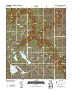
~ Chavez Mountain West AZ topo map, 1:24000 scale, 7.5 X 7.5 Minute, Historical, 2011
Chavez Mountain West, Arizona, USGS topographic map dated 2011.
Includes geographic coordinates (latitude and longitude). This topographic map is suitable for hiking, camping, and exploring, or framing it as a wall map.
Printed on-demand using high resolution imagery, on heavy weight and acid free paper, or alternatively on a variety of synthetic materials.
Topos available on paper, Waterproof, Poly, or Tyvek. Usually shipping rolled, unless combined with other folded maps in one order.
- Product Number: USGS-5559037
- Free digital map download (high-resolution, GeoPDF): Chavez Mountain West, Arizona (file size: 22 MB)
- Map Size: please refer to the dimensions of the GeoPDF map above
- Weight (paper map): ca. 55 grams
- Map Type: POD USGS Topographic Map
- Map Series: US Topo
- Map Verison: Historical
- Cell ID: 8296
- Datum: North American Datum of 1983
- Map Projection: Transverse Mercator
- Map Cell Name: Chavez Mountain West
- Grid size: 7.5 X 7.5 Minute
- Date on map: 2011
- Map Scale: 1:24000
- Geographical region: Arizona, United States
Neighboring Maps:
All neighboring USGS topo maps are available for sale online at a variety of scales.
Spatial coverage:
Topo map Chavez Mountain West, Arizona, covers the geographical area associated the following places:
- Red Flat Tank - Lockwood Tank - Diablo Tank - Natural Tank - Pratt Tank - Soldier Annex Dam - West Broomy Valley Tank - Rice Tank - Bullfight Tank - Long Lake North Boat Launch - Ash Tank - Chavez Well - Sears Tank - Sawmill Wash - Lewis Tank - Hidden Tank - East Broomy Valley Tank - Upper Diablo Tank - Antelope Tank Ditch - Roadside Tank - Crater Lake - Long Lake South Boat Launch - East Soldier Tank - Soldier Annex Lake - Limestone Tank - Lockwood Park - Tremaine Lake - Upper Chavez Tank - Carpenter Tank - Soldier Lake - Tommie Tank - Borrow Tank - Bog Tank - Antelope Tank - Red Lake - Long Lake - Broomy Valley - Chavez Pass
- Map Area ID: AREA34.87534.75-111.25-111.125
- Northwest corner Lat/Long code: USGSNW34.875-111.25
- Northeast corner Lat/Long code: USGSNE34.875-111.125
- Southwest corner Lat/Long code: USGSSW34.75-111.25
- Southeast corner Lat/Long code: USGSSE34.75-111.125
- Northern map edge Latitude: 34.875
- Southern map edge Latitude: 34.75
- Western map edge Longitude: -111.25
- Eastern map edge Longitude: -111.125


