
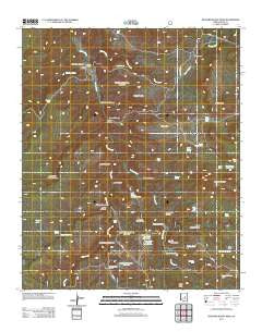
~ Buzzard Roost Mesa AZ topo map, 1:24000 scale, 7.5 X 7.5 Minute, Historical, 2011
Buzzard Roost Mesa, Arizona, USGS topographic map dated 2011.
Includes geographic coordinates (latitude and longitude). This topographic map is suitable for hiking, camping, and exploring, or framing it as a wall map.
Printed on-demand using high resolution imagery, on heavy weight and acid free paper, or alternatively on a variety of synthetic materials.
Topos available on paper, Waterproof, Poly, or Tyvek. Usually shipping rolled, unless combined with other folded maps in one order.
- Product Number: USGS-5559025
- Free digital map download (high-resolution, GeoPDF): Buzzard Roost Mesa, Arizona (file size: 25 MB)
- Map Size: please refer to the dimensions of the GeoPDF map above
- Weight (paper map): ca. 55 grams
- Map Type: POD USGS Topographic Map
- Map Series: US Topo
- Map Verison: Historical
- Cell ID: 6530
- Datum: North American Datum of 1983
- Map Projection: Transverse Mercator
- Map Cell Name: Buzzard Roost Mesa
- Grid size: 7.5 X 7.5 Minute
- Date on map: 2011
- Map Scale: 1:24000
- Geographical region: Arizona, United States
Neighboring Maps:
All neighboring USGS topo maps are available for sale online at a variety of scales.
Spatial coverage:
Topo map Buzzard Roost Mesa, Arizona, covers the geographical area associated the following places:
- Brushy Canyon - Breadpan Spring - Walnut Creek - Spring Creek Ranch - Breadpan Canyon - Dinner Creek - El Paso Canyon - Clover Canyon - Cline Mesa - Haught Ranch - Buzzard Roost Mesa Tank Number Two - Flying W Ranch - Clover Spring - Pasture Tank - Juniper Tank - Peters Corral - Bryant Canyon Tank - Jim Sam Butte - Walnut Well - Little Walnut Canyon - Ansel Spring - Clover Spring Tank - Buzzard Roost Camp - Mailbox Mesa - Mine Tank - Jerky Butte - Peters Corral Spring - Buzzard Roost Mesa - Bench Tank - Thomas Canyon - Potato Butte - Bryant Canyon Spring - Bryant Mountain - Fred Tank - Cabin Trail Tank - Peters Corral Canyon - Mine Canyon - Shipping Pasture Tank - Thomas Spring - Jim Sam Tank - Buzzard Roost Mesa Tank Number One - Brady Canyon - Dinner Canyon - Hog Tank - South Buzzard Roost Mesa Tank - No Name Tank - Clear Tank - Upper Bryant Canyon Tank - Little Walnut Tank - Spring Creek Mine - North Buzzard Roost Mesa Tank - Sevenmile Canyon - Bryant Canyon - Buzzard Roost Canyon - Rock Creek - Houdon Cabin - North Fork Brady Canyon
- Map Area ID: AREA34.12534-111.125-111
- Northwest corner Lat/Long code: USGSNW34.125-111.125
- Northeast corner Lat/Long code: USGSNE34.125-111
- Southwest corner Lat/Long code: USGSSW34-111.125
- Southeast corner Lat/Long code: USGSSE34-111
- Northern map edge Latitude: 34.125
- Southern map edge Latitude: 34
- Western map edge Longitude: -111.125
- Eastern map edge Longitude: -111


