
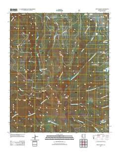
~ Mount Baldy AZ topo map, 1:24000 scale, 7.5 X 7.5 Minute, Historical, 2011
Mount Baldy, Arizona, USGS topographic map dated 2011.
Includes geographic coordinates (latitude and longitude). This topographic map is suitable for hiking, camping, and exploring, or framing it as a wall map.
Printed on-demand using high resolution imagery, on heavy weight and acid free paper, or alternatively on a variety of synthetic materials.
Topos available on paper, Waterproof, Poly, or Tyvek. Usually shipping rolled, unless combined with other folded maps in one order.
- Product Number: USGS-5559007
- Free digital map download (high-resolution, GeoPDF): Mount Baldy, Arizona (file size: 27 MB)
- Map Size: please refer to the dimensions of the GeoPDF map above
- Weight (paper map): ca. 55 grams
- Map Type: POD USGS Topographic Map
- Map Series: US Topo
- Map Verison: Historical
- Cell ID: 30481
- Datum: North American Datum of 1983
- Map Projection: Transverse Mercator
- Map Cell Name: Mount Baldy
- Grid size: 7.5 X 7.5 Minute
- Date on map: 2011
- Map Scale: 1:24000
- Geographical region: Arizona, United States
Neighboring Maps:
All neighboring USGS topo maps are available for sale online at a variety of scales.
Spatial coverage:
Topo map Mount Baldy, Arizona, covers the geographical area associated the following places:
- Boardshack Knoll - Draw Stock Tank - 273 Tank Number 2 - Mount Thomas - Sheep Crossing/Baldy Ninetyfour Trail - Mount Baldy - White Mountains - Purcell Cienega - Mount Ord - Damoff Cabin - Smith Cienega - Bull Cienega - Baldy Peak - Slade Ranch - Mount Warren - H L Draw Tank - Bonito Cienega - Hall Cienega - Lee Valley Reservoir - Sunrise Peak Ski Area - Paradise Butte - Sunrise Peak - Mount Baldy Wilderness - Mitt Tank - Sheep Crossing Campground - 273 Tank Number 1 - Pit Spring - Sunrise Ski Lodge
- Map Area ID: AREA3433.875-109.625-109.5
- Northwest corner Lat/Long code: USGSNW34-109.625
- Northeast corner Lat/Long code: USGSNE34-109.5
- Southwest corner Lat/Long code: USGSSW33.875-109.625
- Southeast corner Lat/Long code: USGSSE33.875-109.5
- Northern map edge Latitude: 34
- Southern map edge Latitude: 33.875
- Western map edge Longitude: -109.625
- Eastern map edge Longitude: -109.5


