
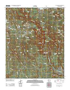
~ Big Lake South AZ topo map, 1:24000 scale, 7.5 X 7.5 Minute, Historical, 2011
Big Lake South, Arizona, USGS topographic map dated 2011.
Includes geographic coordinates (latitude and longitude). This topographic map is suitable for hiking, camping, and exploring, or framing it as a wall map.
Printed on-demand using high resolution imagery, on heavy weight and acid free paper, or alternatively on a variety of synthetic materials.
Topos available on paper, Waterproof, Poly, or Tyvek. Usually shipping rolled, unless combined with other folded maps in one order.
- Product Number: USGS-5558999
- Free digital map download (high-resolution, GeoPDF): Big Lake South, Arizona (file size: 28 MB)
- Map Size: please refer to the dimensions of the GeoPDF map above
- Weight (paper map): ca. 55 grams
- Map Type: POD USGS Topographic Map
- Map Series: US Topo
- Map Verison: Historical
- Cell ID: 3762
- Datum: North American Datum of 1983
- Map Projection: Transverse Mercator
- Map Cell Name: Big Lake South
- Grid size: 7.5 X 7.5 Minute
- Date on map: 2011
- Map Scale: 1:24000
- Geographical region: Arizona, United States
Neighboring Maps:
All neighboring USGS topo maps are available for sale online at a variety of scales.
Spatial coverage:
Topo map Big Lake South, Arizona, covers the geographical area associated the following places:
- Fir Spring - Redondo Tank - Section 26 Tank - Lagoon Tank - PN Spring - Rainbow Campground - Lost Spring - Conklin Tank - East Draw Tank - Center Tank - Cutthroat Campground - Section Eleven Tank - Duck Lake Tank - Fork Tank - Turkey Tank - OK Spring - West Fork Forest Camp - Skin Spring Tank - Cienega Fourteen Tank - Fence Pit Tank - Resspass Tank - Boggy Pit Tank - Big Lake Lookout - Indian Spring - Section Thirteen Tank - Slade Tank - Hay Creek - Yes Tank - Railroad Loop Tank - Boggy Tank - Conklin Ridge - Reservoir Tank - P S Ranch - Skin Spring Tank - Section Sixteen Tank - Grayling Campground - Middle Prong Spring - Colonel Spring Forest Camp - Old Spring - South Tank - Merv Tank - Deer Tank - Apache Trout Campground - Center Fire Tank - Conklin Spring - Hall Tank - Slade Spring - House Tank - Home Creek - Section Fourteen Tank - Reservation Tank - Upper Conklin Tank - Hayground Tank Number One - Big Lake Knoll - Larry Flat Tank - Blow Draw - Upper Horse Tank Number Two - P S Knoll Lookout Tower - Lower Hayground Tank - Center Tank - Upper Horse Tank Number One - Hay Creek Tank - Spillman Spring - Reservation Ranch - Deadman Spring - Rail Spring - Slide Draw Tank - Neck Tank - Big Lake South Cove Boat Launch - Homestead Spring - P S Knoll - Lou Tank - Duck Lake - Home Creek Tank - Black Tank - Haygrounds - Hayground Tank - East Draw - Section Ten Tank - West Fork Campground - Section 30 Tank - Dry Tank - Must Spring - Deadman Crossing - Section Twenty-Eight Tank - 285 Tank - Colonel Spring
- Map Area ID: AREA33.87533.75-109.5-109.375
- Northwest corner Lat/Long code: USGSNW33.875-109.5
- Northeast corner Lat/Long code: USGSNE33.875-109.375
- Southwest corner Lat/Long code: USGSSW33.75-109.5
- Southeast corner Lat/Long code: USGSSE33.75-109.375
- Northern map edge Latitude: 33.875
- Southern map edge Latitude: 33.75
- Western map edge Longitude: -109.5
- Eastern map edge Longitude: -109.375


