
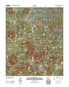
~ Boundary Butte AZ topo map, 1:24000 scale, 7.5 X 7.5 Minute, Historical, 2011
Boundary Butte, Arizona, USGS topographic map dated 2011.
Includes geographic coordinates (latitude and longitude). This topographic map is suitable for hiking, camping, and exploring, or framing it as a wall map.
Printed on-demand using high resolution imagery, on heavy weight and acid free paper, or alternatively on a variety of synthetic materials.
Topos available on paper, Waterproof, Poly, or Tyvek. Usually shipping rolled, unless combined with other folded maps in one order.
- Product Number: USGS-5558767
- Free digital map download (high-resolution, GeoPDF): Boundary Butte, Arizona (file size: 31 MB)
- Map Size: please refer to the dimensions of the GeoPDF map above
- Weight (paper map): ca. 55 grams
- Map Type: POD USGS Topographic Map
- Map Series: US Topo
- Map Verison: Historical
- Cell ID: 4993
- Datum: North American Datum of 1983
- Map Projection: Transverse Mercator
- Map Cell Name: Boundary Butte
- Grid size: 7.5 X 7.5 Minute
- Date on map: 2011
- Map Scale: 1:24000
- Geographical region: Arizona, United States
Neighboring Maps:
All neighboring USGS topo maps are available for sale online at a variety of scales.
Spatial coverage:
Topo map Boundary Butte, Arizona, covers the geographical area associated the following places:
- Cerro Gordon Mountain - Casimero Spring - Silver Spring - Pierce Spring - Brady Spring - Jog Tank - Butler Mountain - Pancho Tank - Gust Reservoir - Section Six Tank - Butte Tank - Circle Tank - Porcupine Tank - Aniceto Cinder Pit - Vernon Cemetery - Brady Park - Pierce Mountain - Pine Spring - Pulcifer Creek - Harris Lake - Tom Canovis Spring - Bosque Tank - Lee Spring - Juan Garcia Mountain - Naegle Ranch - Gillespie Flat - Wolf Mountain - Willow Spring - Pancho Spring - Boundary Spring Tank - Boundary Tanks - Porter Lake - Pancho Spring - Buckelew Spring - Boundary Tank - Gillespie Tank - Coon Spring - Wishbone Mountain - Porter Spring - Aniceto Spring - Lee Tank - Pine Spring - Pit Spring - Section Twenty Tank - Gust Spring - Timber Knoll - San Juan Tanks - Mineral Ditch - Private Tank - Ojo Bonito Tank - Arab Tank - Firebox Spring - Aniceto Tank - San Juan Flat - Butler Tak - Bear Tank - Vernon Elementary School - San Juan Lake - Carlock Ranch - Goodman Spring - Brown Wash - Gillespie Spring - Aspen Spring - Elk Tank - Antelope Hills - Vernon Creek - Turkey Spring - Garris Knoll - Serviceberry Hill - Coon Mountain - Quakie Patch Spring - Boundary Butte - Naegle Tank - McKay Spring - Oak Spring - Bosque Spring - Section Thirty Tank - Aniceto Knoll
- Map Area ID: AREA34.2534.125-109.75-109.625
- Northwest corner Lat/Long code: USGSNW34.25-109.75
- Northeast corner Lat/Long code: USGSNE34.25-109.625
- Southwest corner Lat/Long code: USGSSW34.125-109.75
- Southeast corner Lat/Long code: USGSSE34.125-109.625
- Northern map edge Latitude: 34.25
- Southern map edge Latitude: 34.125
- Western map edge Longitude: -109.75
- Eastern map edge Longitude: -109.625


