
~ Lion Mountain AZ topo map, 1:24000 scale, 7.5 X 7.5 Minute, Historical, 2011
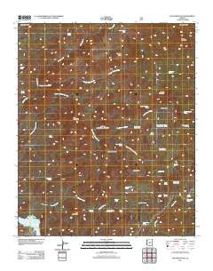
Lion Mountain, Arizona, USGS topographic map dated 2011.
Includes geographic coordinates (latitude and longitude). This topographic map is suitable for hiking, camping, and exploring, or framing it as a wall map.
Printed on-demand using high resolution imagery, on heavy weight and acid free paper, or alternatively on a variety of synthetic materials.
Topos available on paper, Waterproof, Poly, or Tyvek. Usually shipping rolled, unless combined with other folded maps in one order.
- Product Number: USGS-5557931
- Free digital map download (high-resolution, GeoPDF): Lion Mountain, Arizona (file size: 27 MB)
- Map Size: please refer to the dimensions of the GeoPDF map above
- Weight (paper map): ca. 55 grams
- Map Type: POD USGS Topographic Map
- Map Series: US Topo
- Map Verison: Historical
- Cell ID: 25859
- Datum: North American Datum of 1983
- Map Projection: Transverse Mercator
- Map Cell Name: Lion Mountain
- Grid size: 7.5 X 7.5 Minute
- Date on map: 2011
- Map Scale: 1:24000
- Geographical region: Arizona, United States
Neighboring Maps:
All neighboring USGS topo maps are available for sale online at a variety of scales.
Spatial coverage:
Topo map Lion Mountain, Arizona, covers the geographical area associated the following places:
- Cat Bay - Upper Alder Creek Spring - Cholla Spring - Upper Sheep Creek Spring - Squaw Flat Spring - Chalk Spring - Marion Spring Number One - Corral Water Spring - Mormon Grove Spring - Dry Lake Tank - Chalk Tank - Saddle Mountain - Brunson Tank - Alder Spring - Sheep Mountain - Chalk Spring Number Two - Marion Spring - Cypress Ridge - Lower Sheep Spring - Story Mine - Saddle Mountain Spring - Dripping Spring - Brush Spring - Trap Spring - Sheep Creek Seep - Middle Water - Lion Mountain - Copper Tank - Copper Camp Creek - Walnut Spring - Potato Patch - S B Mountain - Lizard Spring - Alder Creek Spring - Tournament Flat - Dripping Spring Number Two - SB Cabin - Canyon Creek - Mormon Grove Trailhead - Squaw Flat - Tournament Creek - Jack Spring - Pats Shoe Spring - Canyon Creek Spring - Black Ridge - Sparks Tank
- Map Area ID: AREA3433.875-111.625-111.5
- Northwest corner Lat/Long code: USGSNW34-111.625
- Northeast corner Lat/Long code: USGSNE34-111.5
- Southwest corner Lat/Long code: USGSSW33.875-111.625
- Southeast corner Lat/Long code: USGSSE33.875-111.5
- Northern map edge Latitude: 34
- Southern map edge Latitude: 33.875
- Western map edge Longitude: -111.625
- Eastern map edge Longitude: -111.5


