
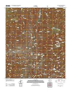
~ Fritz Canyon AZ topo map, 1:24000 scale, 7.5 X 7.5 Minute, Historical, 2011
Fritz Canyon, Arizona, USGS topographic map dated 2011.
Includes geographic coordinates (latitude and longitude). This topographic map is suitable for hiking, camping, and exploring, or framing it as a wall map.
Printed on-demand using high resolution imagery, on heavy weight and acid free paper, or alternatively on a variety of synthetic materials.
Topos available on paper, Waterproof, Poly, or Tyvek. Usually shipping rolled, unless combined with other folded maps in one order.
- Product Number: USGS-5557763
- Free digital map download (high-resolution, GeoPDF): Fritz Canyon, Arizona (file size: 26 MB)
- Map Size: please refer to the dimensions of the GeoPDF map above
- Weight (paper map): ca. 55 grams
- Map Type: POD USGS Topographic Map
- Map Series: US Topo
- Map Verison: Historical
- Cell ID: 16496
- Datum: North American Datum of 1983
- Map Projection: Transverse Mercator
- Map Cell Name: Fritz Canyon
- Grid size: 7.5 X 7.5 Minute
- Date on map: 2011
- Map Scale: 1:24000
- Geographical region: Arizona, United States
Neighboring Maps:
All neighboring USGS topo maps are available for sale online at a variety of scales.
Spatial coverage:
Topo map Fritz Canyon, Arizona, covers the geographical area associated the following places:
- Wild Bunch Canyon - Little Blue Creek - Rock Tank Canyon - Number One Tank - Mud Springs Canyon - Hobo Spring - Wild Bunch Corral - Black Jack Tank - Lower Clear Creek Corral - Sweet Spring - Horse Canyon Corral - Wild Bear Spring - Suicide Tank - Buckhorn Canyon Tank - Mud Springs Corral - Big Horn Spring - Upper Cienega Corral - Lower Tank - Dry Prong Canyon - Sen Canyon Tank - Hobo Number Four Tanks - Sandrock Corral - Jeep Tank - Manning Tank - Manning Corral - Divide Spring - Tea Bag Springs Number Three - Suicide Canyon - Alder Creek - Upper Mud Spring - Joe Fritz Pasture Tank - Holding Cienega Spring - Upper Spring - Sunflower Saddle Tank - Roan Cow Tank - Dry Prong Seep - Pinon Mountain Corral - Dry Lake Tank - Tea Bag Springs Number Two - No Tank - Pungent Spring - Joe Fritz Corral - Pat Mesa - Jump Up Tank - Fish Spring - Baseline Corral - Juan Miller Creek - Open Canyon - Sour Spring - Head of Wild Bunch Spring - White Bluff Tank - Alder Corral - Fritz Ranch - Cienega Corral Cabin - Asma Corral - Sunflower Saddle - Spring Canyon - Alder Spring - Roan Cow Canyon - Garage Tank - Lower Wild Bunch Corral - Stacy Ranch - Wild Bunch Tank - Porky Canyon - Suicide Spring - White Saddle Tank - Burns Spring - Lemonade Spring - Pigeon Creek - Pocket Spring - Big Saddle Tank - Harry Canyon - Cienega Creek - Cow Spring - Cienega Creek Number Two Corral - Tea Bag Springs Number One - Pat Mountain - Cienega Spring - Horse Canyon - Clear Creek - Pasture Wells Corral - Fritz Spring - Horse Canyon Ridge Spring - The Spring - Yellowstone Tank - Maple Spring - Onery Spring - Upper Salt Ground Tank - Rock Tank Spring - Maple Number One Tank - Buckhorn Tank - Upper Cienega Spring - Rattlesnake Spring - Winter Camp Tank - Bear Creek - Clear Creek Ridge Tank - Maple Canyon - Horse Canyon Cabin - Horse Canyon Ridge Tank - Mud Spring
- Map Area ID: AREA33.37533.25-109.25-109.125
- Northwest corner Lat/Long code: USGSNW33.375-109.25
- Northeast corner Lat/Long code: USGSNE33.375-109.125
- Southwest corner Lat/Long code: USGSSW33.25-109.25
- Southeast corner Lat/Long code: USGSSE33.25-109.125
- Northern map edge Latitude: 33.375
- Southern map edge Latitude: 33.25
- Western map edge Longitude: -109.25
- Eastern map edge Longitude: -109.125


