
~ Dutch Blue Creek AZ topo map, 1:24000 scale, 7.5 X 7.5 Minute, Historical, 2011
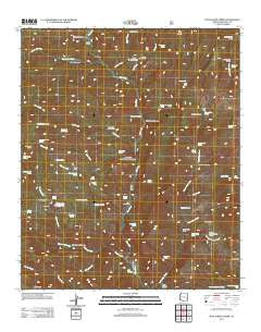
Dutch Blue Creek, Arizona, USGS topographic map dated 2011.
Includes geographic coordinates (latitude and longitude). This topographic map is suitable for hiking, camping, and exploring, or framing it as a wall map.
Printed on-demand using high resolution imagery, on heavy weight and acid free paper, or alternatively on a variety of synthetic materials.
Topos available on paper, Waterproof, Poly, or Tyvek. Usually shipping rolled, unless combined with other folded maps in one order.
- Product Number: USGS-5557761
- Free digital map download (high-resolution, GeoPDF): Dutch Blue Creek, Arizona (file size: 27 MB)
- Map Size: please refer to the dimensions of the GeoPDF map above
- Weight (paper map): ca. 55 grams
- Map Type: POD USGS Topographic Map
- Map Series: US Topo
- Map Verison: Historical
- Cell ID: 13157
- Datum: North American Datum of 1983
- Map Projection: Transverse Mercator
- Map Cell Name: Dutch Blue Creek
- Grid size: 7.5 X 7.5 Minute
- Date on map: 2011
- Map Scale: 1:24000
- Geographical region: Arizona, United States
Neighboring Maps:
All neighboring USGS topo maps are available for sale online at a variety of scales.
Spatial coverage:
Topo map Dutch Blue Creek, Arizona, covers the geographical area associated the following places:
- Auger Creek Spring - Ash Creek - Benton Tank - Paint Rock Prairie - Lower Oak Creek Corral - Oak Creek - Bull Creek - VT Ranch - Zuni Basin - Bell Springs - VT Pasture Tank - Alder Peak - H U Bar Ranch - Winter Cabin - Hannah Hot Spring - Auger Canyon - Squaw Creek - Blue River One Hundred One Trail - Bull Basin Spring - Hannah Spring Canyon Corral - Syeamore Corral - Stray Horse Canyon Trail Twenty - Horsehead Spring - Auger Corral - Trap Corral - Owl Creek - Latherone Spring - Benton Creek - Ash Spring - Bonehead Spring - Hannah Springs Creek - Bear Trough Spring - Dutch Chimney Corral - Bull Spring - Sycamore Canyon - Government Mesa - H U Bar Box - Little Blue Box - White Rocks Cabin - Tornado Canyon - Strayhorse Creek - Beeler Creek - Hu Bar Spring - Dead Mule Spring - Pasture Tank - Rousensock Canyon - Shorty Spring - Ladron Spring - Benton Creek Spring - Dutch Blue Creek - North Bull Creek Tank - Auger Creek - Hammerhead Spring - Little Dutch Spring - Board Canyon - Al Creek Corral - Auger Tank - Ladrone Canyon - Salt Basin - H U Bar Tank - Bull Basin Corral - Thomas Creek - Smith Cabin - Yellow Springs - Jack Rabbit Spring - Bonehead Basin - Bench Spring - Benton Falls Tank - Beeler Creek Corral - Post Canyon - Winter Cabin Spring - North Bull Creek - Yellow Spring - Mangrum Spring - Hobo Canyon - Rousensock Creek
- Map Area ID: AREA33.533.375-109.25-109.125
- Northwest corner Lat/Long code: USGSNW33.5-109.25
- Northeast corner Lat/Long code: USGSNE33.5-109.125
- Southwest corner Lat/Long code: USGSSW33.375-109.25
- Southeast corner Lat/Long code: USGSSE33.375-109.125
- Northern map edge Latitude: 33.5
- Southern map edge Latitude: 33.375
- Western map edge Longitude: -109.25
- Eastern map edge Longitude: -109.125


