
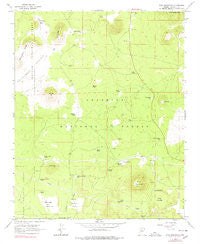
~ Wing Mountain AZ topo map, 1:24000 scale, 7.5 X 7.5 Minute, Historical, 1966, updated 1991
Wing Mountain, Arizona, USGS topographic map dated 1966.
Includes geographic coordinates (latitude and longitude). This topographic map is suitable for hiking, camping, and exploring, or framing it as a wall map.
Printed on-demand using high resolution imagery, on heavy weight and acid free paper, or alternatively on a variety of synthetic materials.
Topos available on paper, Waterproof, Poly, or Tyvek. Usually shipping rolled, unless combined with other folded maps in one order.
- Product Number: USGS-5557411
- Free digital map download (high-resolution, GeoPDF): Wing Mountain, Arizona (file size: 8 MB)
- Map Size: please refer to the dimensions of the GeoPDF map above
- Weight (paper map): ca. 55 grams
- Map Type: POD USGS Topographic Map
- Map Series: HTMC
- Map Verison: Historical
- Cell ID: 49472
- Scan ID: 314149
- Imprint Year: 1991
- Woodland Tint: Yes
- Photo Inspection Year: 1974
- Aerial Photo Year: 1964
- Field Check Year: 1966
- Datum: NAD27
- Map Projection: Polyconic
- Map published by United States Geological Survey
- Map Language: English
- Scanner Resolution: 600 dpi
- Map Cell Name: Wing Mountain
- Grid size: 7.5 X 7.5 Minute
- Date on map: 1966
- Map Scale: 1:24000
- Geographical region: Arizona, United States
Neighboring Maps:
All neighboring USGS topo maps are available for sale online at a variety of scales.
Spatial coverage:
Topo map Wing Mountain, Arizona, covers the geographical area associated the following places:
- Spring Tank - Pulp Tank - Hockderfer Trick Tank - Deer Trick Tank - Two Tanks - East Wing Tank - Calf Trick Tank - Ackel Tank - Walker Hill Tank - Wild Bill Hill - Pine Trick Tank - Grand Canyon Tank - Hidden Hollow Tank - Walker Tank - Moore Tank - Walker Hill - Government Knolls - Water Haul Tank - Aspen Tank - Little Wing Mountain - Wing Mountain - Little Horse Tank - Stagecoach Tank - Camp Two Flat - Volunteer Wash - Bradley Tank - Elk Tank - Wild Bill Tank - Bunk Tank - Hidden Tank (historical) - Johnson Tank - Antelope Hill - Badger Tank - Transwestern Pumping Station - Pearson Spring - Camp Number Two Tank - Gas Tank - Sayre Tank - Coop Tank - Little Wing Tank - Malpais Tank - Horchderffer Tank - Taylor Tank - Cat Trick Tank - Crater Lake - One Eight Tank - Camp Z Tank - Pipeline Tank - Holding Pasture Tank - Maxwell Spring - Bill Tank - South Wing Tank - Aspen Tank - Drowned Timber Tank - Arkansas Tank - Fort Valley Experimental Forest - Orchard Trick Tank - Brannigan Flat - Maxwell Tank - Twin Tanks - Dent Tank - Raymond Tank - Michelbach Tank - West Wing Tank - Brannigan Flat Tank - South Crater Tank - Basalt Tank
- Map Area ID: AREA35.37535.25-111.875-111.75
- Northwest corner Lat/Long code: USGSNW35.375-111.875
- Northeast corner Lat/Long code: USGSNE35.375-111.75
- Southwest corner Lat/Long code: USGSSW35.25-111.875
- Southeast corner Lat/Long code: USGSSE35.25-111.75
- Northern map edge Latitude: 35.375
- Southern map edge Latitude: 35.25
- Western map edge Longitude: -111.875
- Eastern map edge Longitude: -111.75


