
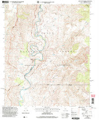
~ Wet Bottom Mesa AZ topo map, 1:24000 scale, 7.5 X 7.5 Minute, Historical, 2004, updated 2007
Wet Bottom Mesa, Arizona, USGS topographic map dated 2004.
Includes geographic coordinates (latitude and longitude). This topographic map is suitable for hiking, camping, and exploring, or framing it as a wall map.
Printed on-demand using high resolution imagery, on heavy weight and acid free paper, or alternatively on a variety of synthetic materials.
Topos available on paper, Waterproof, Poly, or Tyvek. Usually shipping rolled, unless combined with other folded maps in one order.
- Product Number: USGS-5557192
- Free digital map download (high-resolution, GeoPDF): Wet Bottom Mesa, Arizona (file size: 15 MB)
- Map Size: please refer to the dimensions of the GeoPDF map above
- Weight (paper map): ca. 55 grams
- Map Type: POD USGS Topographic Map
- Map Series: HTMC
- Map Verison: Historical
- Cell ID: 48482
- Scan ID: 314039
- Imprint Year: 2007
- Woodland Tint: Yes
- Aerial Photo Year: 2003
- Datum: NAD83
- Map Projection: Polyconic
- Map published by United States Geological Survey
- Map published by United States Forest Service
- Map Language: English
- Scanner Resolution: 600 dpi
- Map Cell Name: Wet Bottom Mesa
- Grid size: 7.5 X 7.5 Minute
- Date on map: 2004
- Map Scale: 1:24000
- Geographical region: Arizona, United States
Neighboring Maps:
All neighboring USGS topo maps are available for sale online at a variety of scales.
Spatial coverage:
Topo map Wet Bottom Mesa, Arizona, covers the geographical area associated the following places:
- Rock Tank Spring - Red Hills - Table Mountain - Marie Spring - Mule Shoe Bend - Petes Cabin Mesa - Goat Camp Canyon - Razorback - Upper Racetrack Mesa - Table Mountain Tank - Goat Camp Creek - Canoe Mesa - Wet Bottom Creek - Red Creek Rapids - Canyon Creek - Cottonwood Creek - Petes Spring - Clover Creek - Peach Tank - Lower Racetrack Mesa - Wet Bottom Mesa
- Map Area ID: AREA34.2534.125-111.75-111.625
- Northwest corner Lat/Long code: USGSNW34.25-111.75
- Northeast corner Lat/Long code: USGSNE34.25-111.625
- Southwest corner Lat/Long code: USGSSW34.125-111.75
- Southeast corner Lat/Long code: USGSSE34.125-111.625
- Northern map edge Latitude: 34.25
- Southern map edge Latitude: 34.125
- Western map edge Longitude: -111.75
- Eastern map edge Longitude: -111.625


