
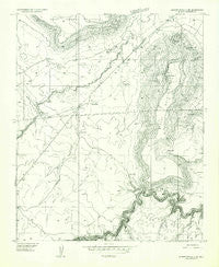
~ Sunset Knoll 2 SW AZ topo map, 1:24000 scale, 7.5 X 7.5 Minute, Historical, 1955, updated 1957
Sunset Knoll 2 SW, Arizona, USGS topographic map dated 1955.
Includes geographic coordinates (latitude and longitude). This topographic map is suitable for hiking, camping, and exploring, or framing it as a wall map.
Printed on-demand using high resolution imagery, on heavy weight and acid free paper, or alternatively on a variety of synthetic materials.
Topos available on paper, Waterproof, Poly, or Tyvek. Usually shipping rolled, unless combined with other folded maps in one order.
- Product Number: USGS-5556344
- Free digital map download (high-resolution, GeoPDF): Sunset Knoll 2 SW, Arizona (file size: 8 MB)
- Map Size: please refer to the dimensions of the GeoPDF map above
- Weight (paper map): ca. 55 grams
- Map Type: POD USGS Topographic Map
- Map Series: HTMC
- Map Verison: Historical
- Cell ID: 43864
- Scan ID: 313603
- Imprint Year: 1957
- Aerial Photo Year: 1953
- Datum: Unstated
- Map Projection: Unstated
- Preliminary map: Yes
- Map published by United States Geological Survey
- Keywords: Nonstandard Press Run
- Map Language: English
- Scanner Resolution: 600 dpi
- Map Cell Name: Sunset Pass
- Grid size: 7.5 X 7.5 Minute
- Date on map: 1955
- Map Scale: 1:24000
- Geographical region: Arizona, United States
Neighboring Maps:
All neighboring USGS topo maps are available for sale online at a variety of scales.
Spatial coverage:
Topo map Sunset Knoll 2 SW, Arizona, covers the geographical area associated the following places:
- Upper Red Tank - Chaucey Tank - Lower Red Tank - Dick Hart Tank - Red Tanks - Fisher Tank - Table Mountain - Robins Tank - Caliche Tank - Limestone Wash - Echinique Draw - Birch Tank - Sunset Pass - Mule Tank - Hidden Tank - Eckles Tank - Rincon Tank - Elk Tank - Gravel Pit Tank - East Sunset Mountain - Mesita Knoll - Fannin Tank
- Map Area ID: AREA34.87534.75-111-110.875
- Northwest corner Lat/Long code: USGSNW34.875-111
- Northeast corner Lat/Long code: USGSNE34.875-110.875
- Southwest corner Lat/Long code: USGSSW34.75-111
- Southeast corner Lat/Long code: USGSSE34.75-110.875
- Northern map edge Latitude: 34.875
- Southern map edge Latitude: 34.75
- Western map edge Longitude: -111
- Eastern map edge Longitude: -110.875


